
Dust Storm Mitigation and Safety
How We're Reducing Risk and Improving Safety
New Mexico’s arid climate, drought, ground-disturbing activities, and high winds all contribute to dust storms that reduce visibility and may cause crashes.
The New Mexico Department of Transportation (NMDOT) partners with private landowners and government agencies to support land restoration and stabilization efforts in areas along our roadways where dust emissions have impacted visibility and posed safety risks for motorists.
Program History
Where We Started
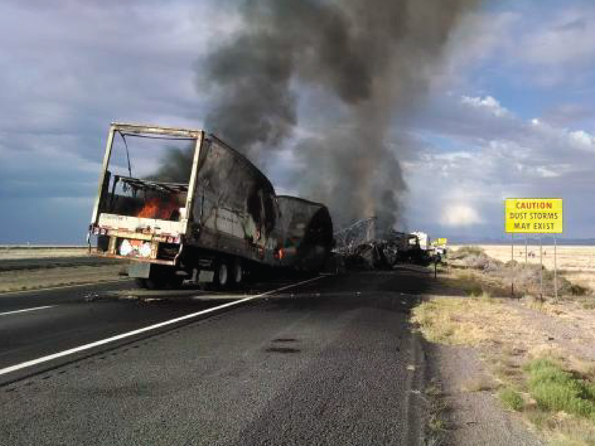
Following a deadly crash on Interstate 10 near Lordsburg in 2014, NMDOT identified numerous dust-emitting ‘hot spots’ prone to cause dust-related crashes and road closures. A mitigation program was launched to address these high-risk areas.
This work has been done in collaboration with the New Mexico State Police (NMSP), Bureau of Land Management (BLM), New Mexico State Land Office (SLO), Natural Resources Conservation Service (NRCS), private landowners, New Mexico State University (NMSU), the U.S. Department of Agriculture (USDA) Jornada Experimental Research and various consultants. In this period NMDOT has designed and implemented a range of mitigation treatments and continues to monitor to evaluate their effectiveness.
Lordsburg Playa Dust Storm Event Statistics
- 1965 – Present: Over 40 dust-visibility related highway deaths
- 2012 – Present: 23 deaths, 45 closures of I-10, 125 dust events requiring DPS/NMDOT response
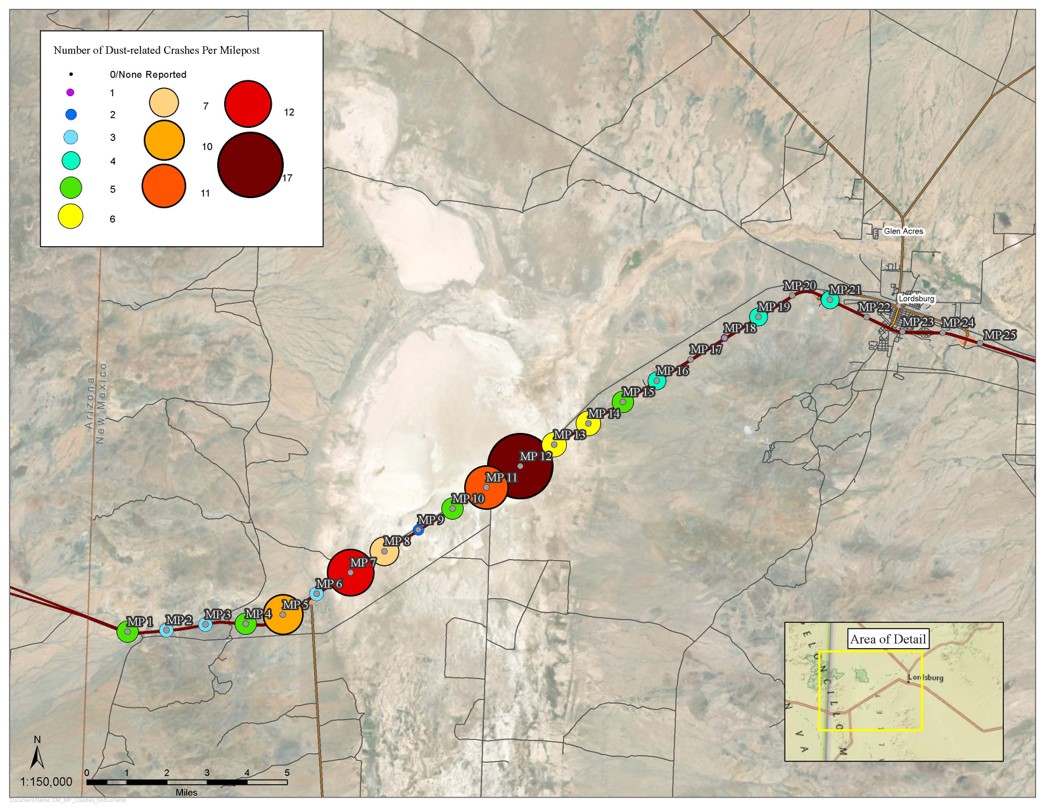
Number of Dust-related Crashes per Milepost
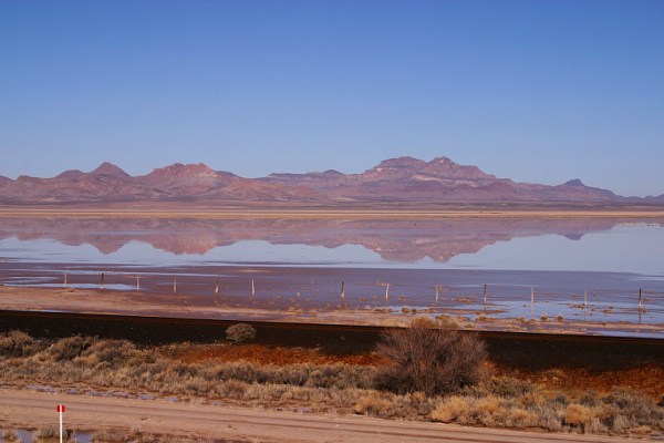
Inside a Dust Storm
Low visibility in the heart of a dust storm.
Safety & Mitigation Activities
Land Use
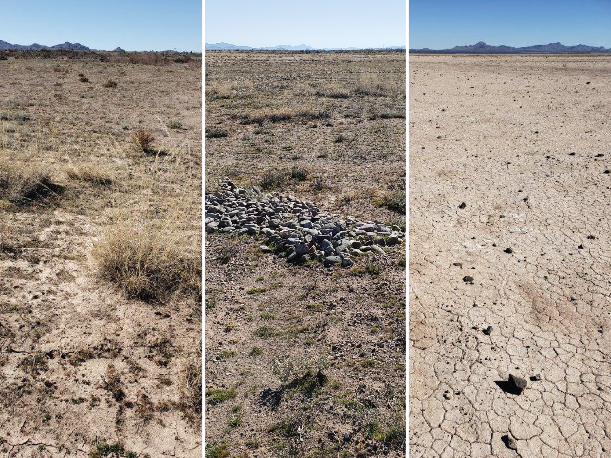
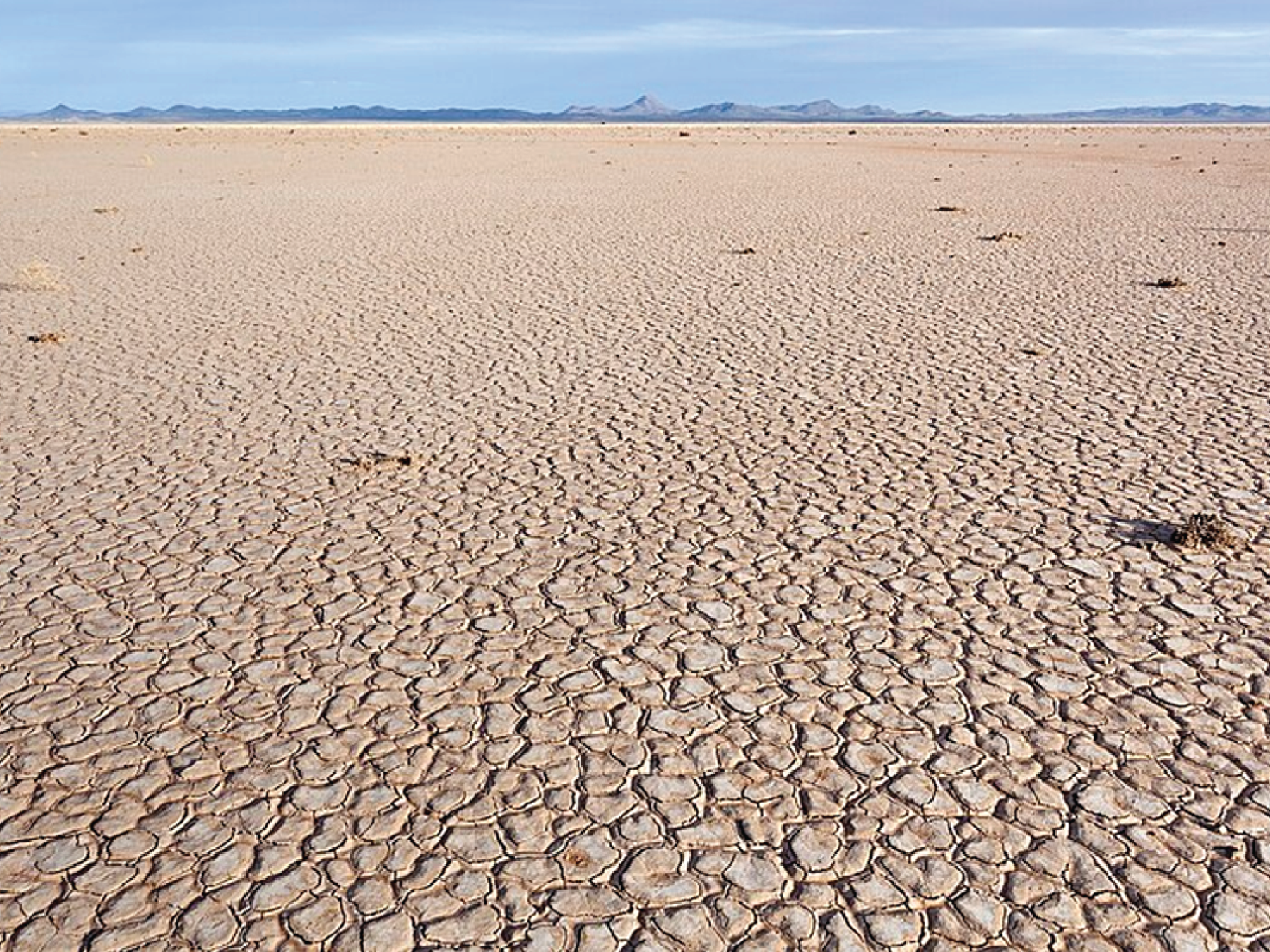
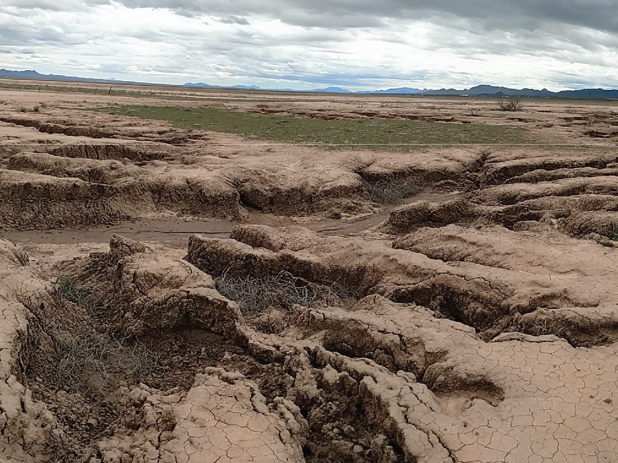
The Lordsburg Playa is a 25-30 square mile dried lakebed located in New Mexico between mile markers 5 and 13 on Interstate-10. It is a mineral soil flats wetland, seasonally inundated in summer and winter, dependent on precipitation runoff, and is also an important pathway for migratory waterfowl. The wetlands are degraded through surface erosion and deposition.
The BLM and SLO own most of the 16,000 acre Lordsburg Playa and lease their acreages out for cattle grazing. There is not much forage there for cattle and the playa surface tends to be broken up when cattle cross between feeding sites. This frees up sand and dust to be picked up by the wind, contributing to dust emissions.
The playa lies on the north and south sides of the highway, with dust storms potentially originating on either side of the highway and from multiple directions. The BLM has an environmental designation called an Area of Critical Environmental Concern (ACEC) which, for public health reasons in this case, may restrict grazing and modify leases. NMDOT is working with the cooperating ranching community and the BLM to see if an ACEC designation can be made. This would require a new management plan for the area, possibly restricting grazing to a high intensity short duration model as found in other arid lands.
Highway Closures
NMDOT works with New Mexico State Police to cruise Interstate-10 and watch for dust storm conditions. The highway is closed (in cooperation with Arizona counterparts) if merited by weather and soil conditions. There are also permanent road signs warning of dust storm conditions.
From January 2014 – June 2017, Interstate-10 near the Lordsburg Playa has been closed 27 times due to blowing dust; 10 of those 27 closures were conducted in coordination with Arizona DOT due to blowing dust issues in Arizona. For example, Interstate-10 was closed on June 21, 2017 after the National Weather Service had visual confirmation of the presence of dust storms. Traffic was diverted onto U.S. 70 on both New Mexico and Arizona side.
Signage
The NMDOT has deployed static and electronic message boards to alert the traveling public of dust hazards in real time. Static or fixed signs warn of dust storm risks and direct motorists to pull off highway during a dust storm. Electronic message boards are illuminated with warnings when winds are high.
Mitigation
The NMDOT initially received a $500,000 grant to reduce windborne dust at the Lordsburg Playa and at a site on U.S. 180. Working with national experts on mitigation as well as with the USDA NRCS, NMDOT implemented re-vegetation and other measures to reduce the amount of windborne dust.
Additionally, NMDOT received $175,000 in funds to monitor the restored sites and $250,000 for a germplasm (seed) development program to develop local varieties of restoration grasses and forbs adapted to this area. In 2021, NMDOT received an additional $1 million to expand and continue mitigation efforts as planned in Phase III.
Mitigation Phase I
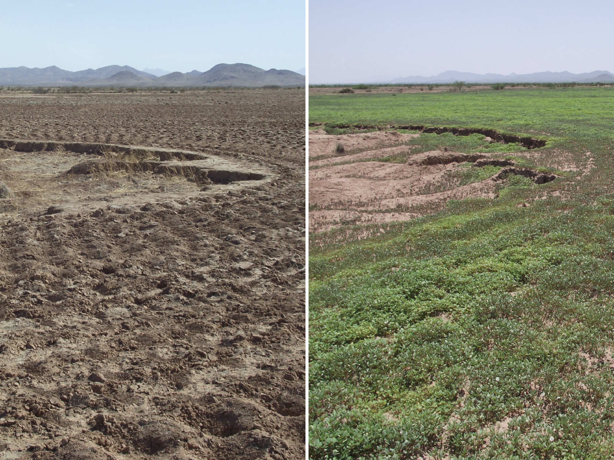
Phase I entailed the restoration of 140 acres of degraded private and SLO land, north of Deming at milepost 151 on the west side of U.S. 180. Fencing was installed, grazing was restricted, and a combination of deep chiseling, plowing and drill seeding were done, in November 2016.
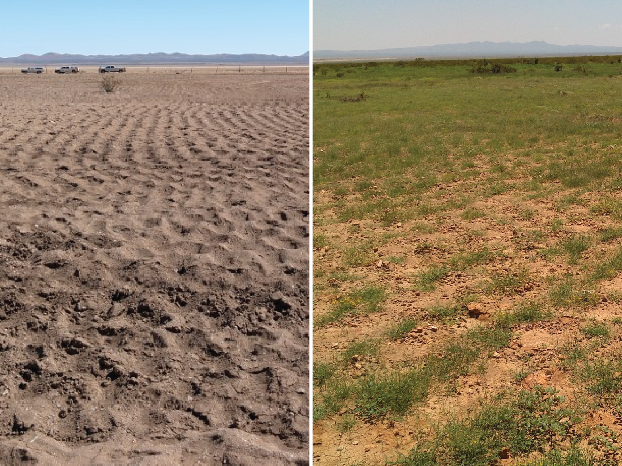
Crust formation and revival of native and seeded vegetation effectively stopped dust emissions from this site. Formerly, U.S. 180 in this area experienced frequent road closures and at least one fatality attributed to dust.
Mitigation Phase II
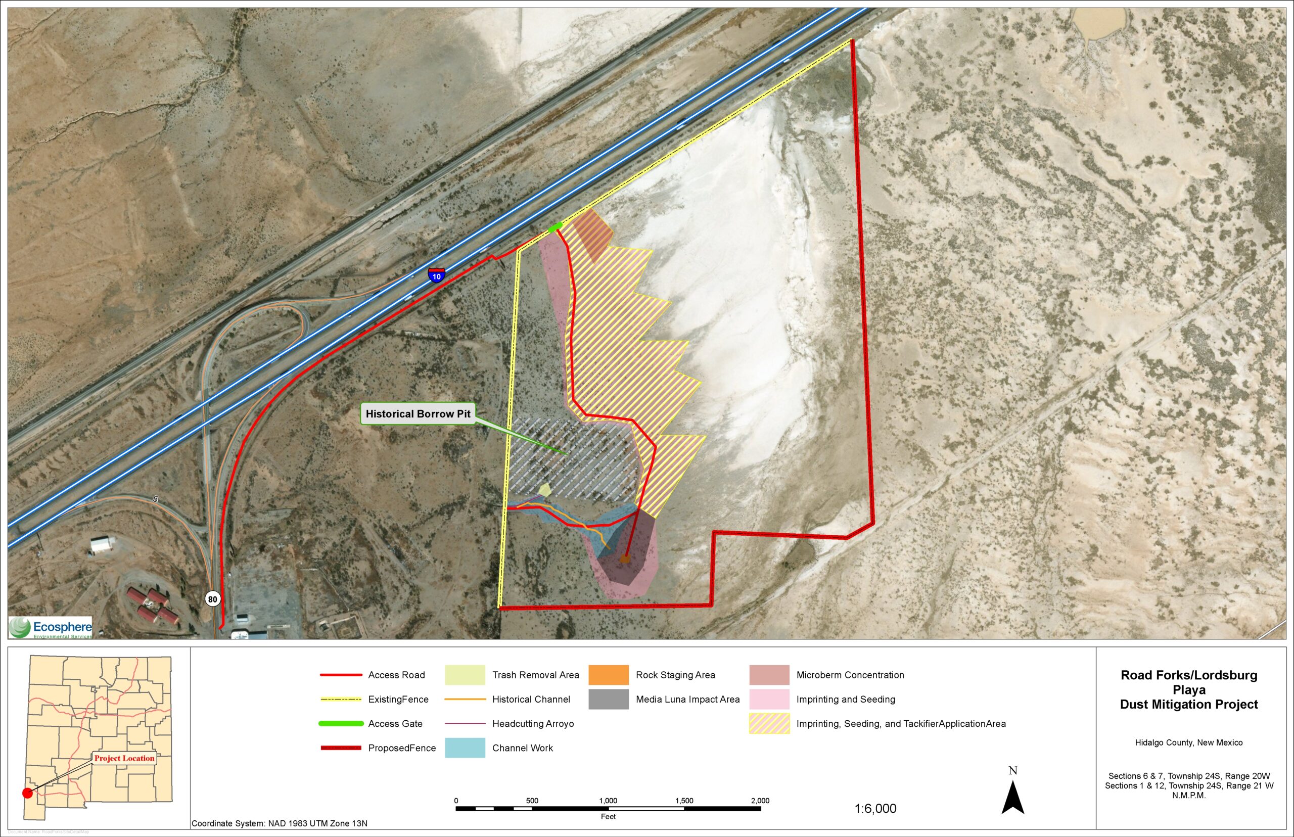
Phase II involves over 200 acres of land within the Lordsburg Playa at the southeast corner of the Road Forks exit at milepost 7 on Interstate-10 and N.M. 80. Through satellite imagery, we determined this was the source of the dust contributing to the April 2014 crash, which claimed 7 lives. Through a land transfer with the BLM, the NMDOT installed fencing to eliminate grazing, graded to re-establish hydrologic flow blocked by ranching activities, and imprinted and over-seeded approximately 13 acres of land along the western shoreline.
As of 2021, establishment of crust on soil surfaces and native and seeded vegetation has diminished dust emissions as indicated by instrumentation monitored by NMSU.
Road Forks Dust Mitigation Area Final Design
Mitigation Phase III
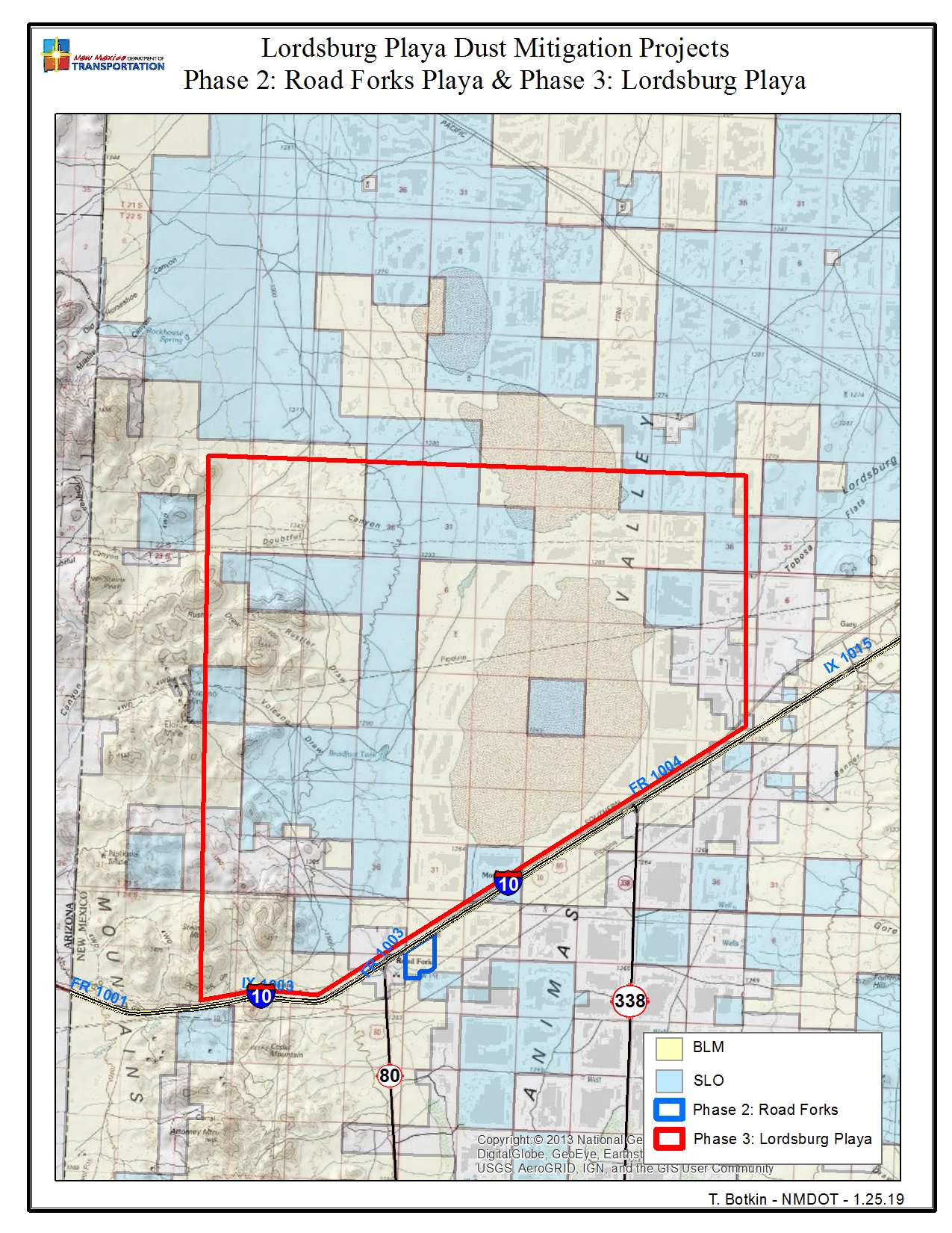
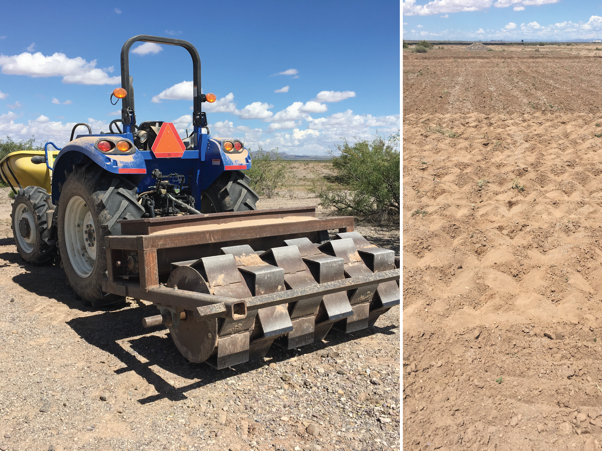
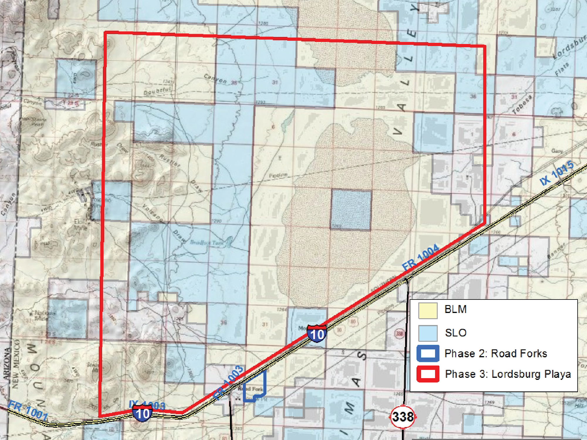
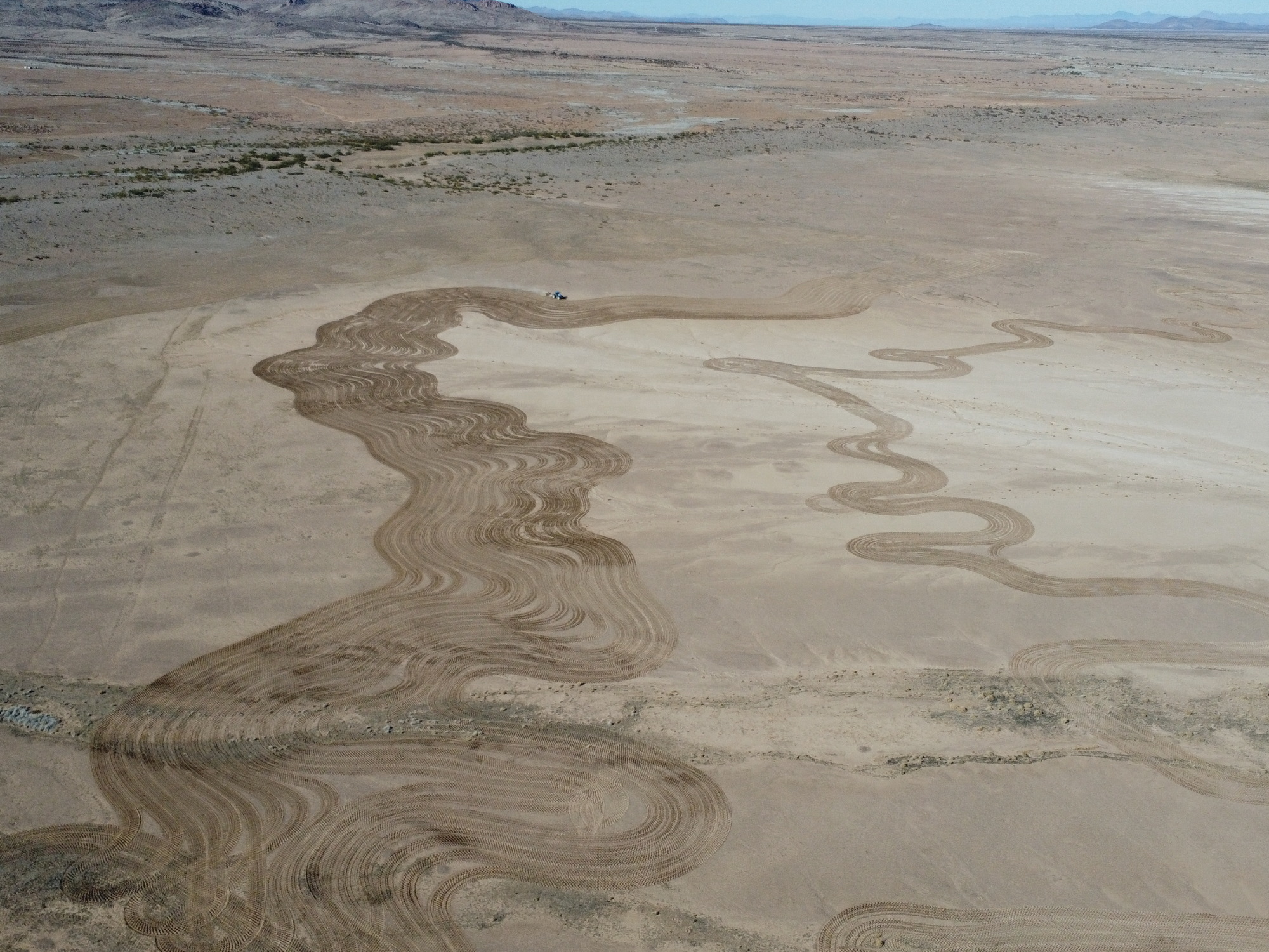
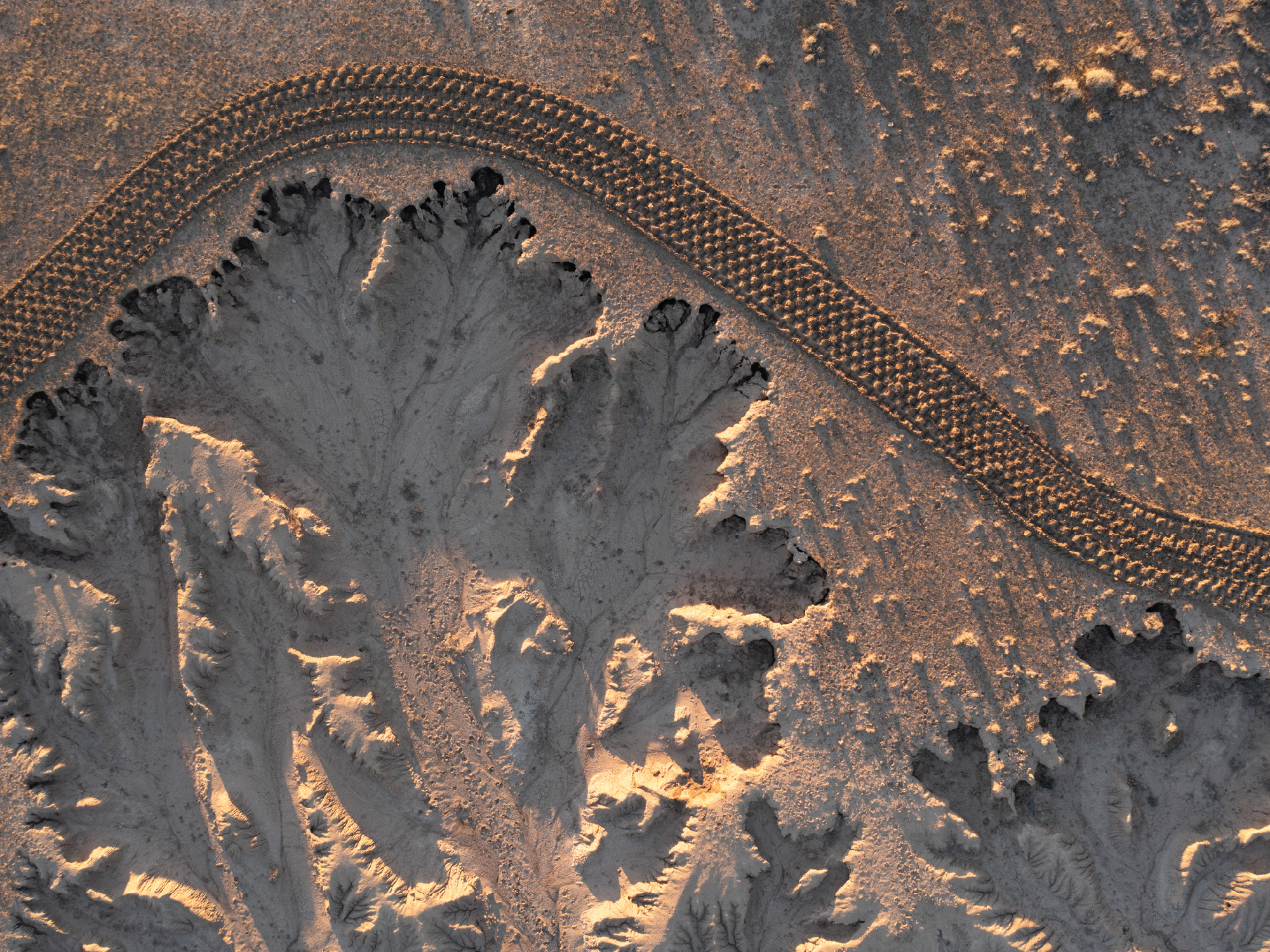
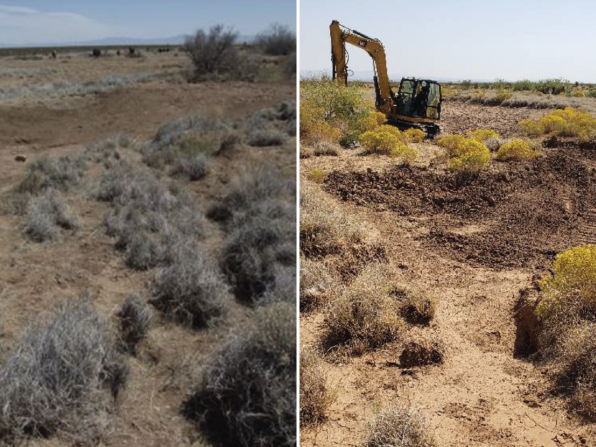
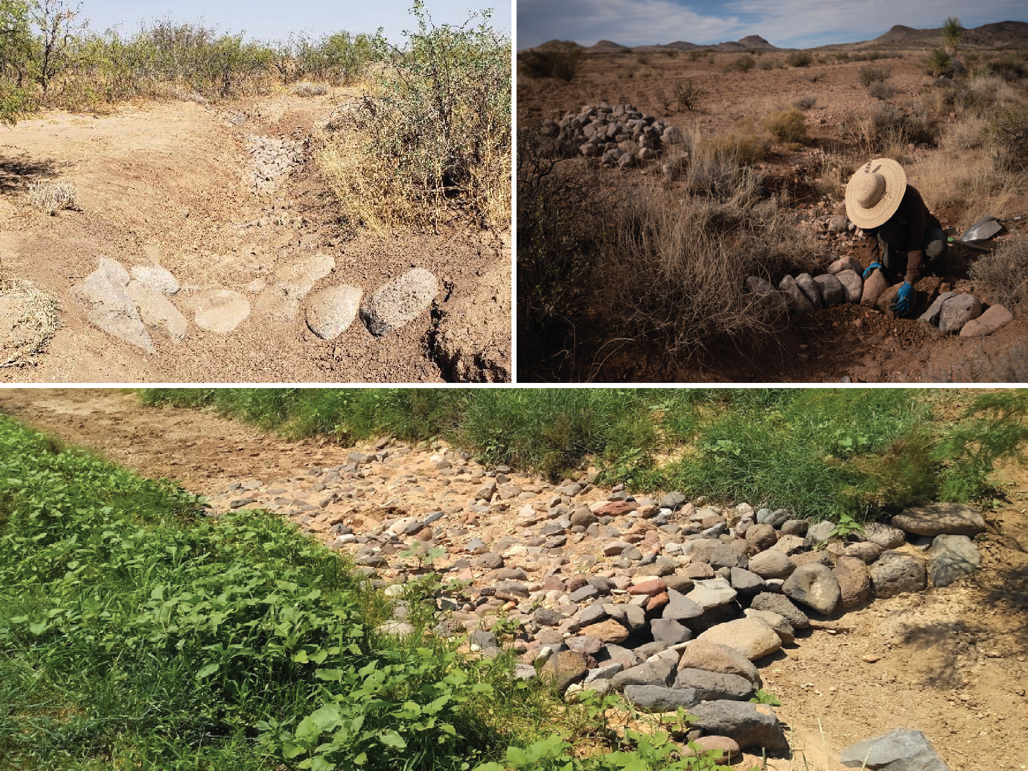
Phase III cumulatively involved 3,000 acres of fenced-off State Trust Land on the western shore line of the Playa just north of I-10. The treatments involved over 1,000 acres of keylining*, imprinting*, tackifier*, and seeding plus check dams and other erosion control measures. Monitoring of air quality and plant density is ongoing.
- Keylining – a technique of using a deep chisel plow to create a slice through a hardpan soil on contour to allow water infiltration
- Imprinting – a technique of using a large weighted roller to make waffle patterns (typically 16” W x 16” W x 8” D) on tilled soil to create mini-watersheds for seed germination
- Tackifier – a mixture of water and a mucilaginous-forming dry powder applied aerially over seeded and mulched areas which dries to form a covering resistant to wind and water erosion
Key Phase 3 Metrics 2020-2024:
- > 1,200 acres imprinted and seeded
- > 1,500 erosion control structures added
- 3,000 acres fences for cattle exclusion for 3 years
Phase 3: Lordsburg Playa and Western Watershed
- 16+ square miles of playa floor
- 35+ square miles of watershed
- Eroding playa surface and western watershed
- Land managed primarily by Bureau of Land Management (BLM) and State Land Office (SLO)
Mitigation Phase IV
Mitigation Phase IV addressed a 40 acre dust ‘hotspot’ on the south side of and adjacent to I-10 at milepost 10 on land managed by the Bureau of Land Management. NMDOT-funded contractors worked cooperatively with the land leasee and the BLM to install 500 ‘macro imprints’ (shallow depressions) across the acreage which was also ripped, seeded, and mulched. Dust emissions have been greatly reduced from the site.
Mitigation Phase V (Ongoing)
Numerous crashes and recent loss of live have been attributed to dust emissions from a 2,000 acre watershed at I-10 milepost 13. NMDOT is working cooperatively with the BLM and State Trust Land to mitigate the dust through watershed restoration, possible drainage improvements on the interstate itself. Work is planned for the winter of 2026.
Dust Storm Detection / Prediction
Dust Mitigation & Erosion Control
Monitoring for Project Success
Vegetation
Keylining, Imprinting, and Seeding
Dust Emissions & Visibility
LiDAR (Light Detection and Ranging)
Uses laser pulses to build a 3D model of a specified topography
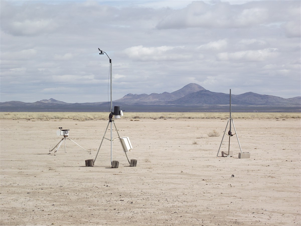
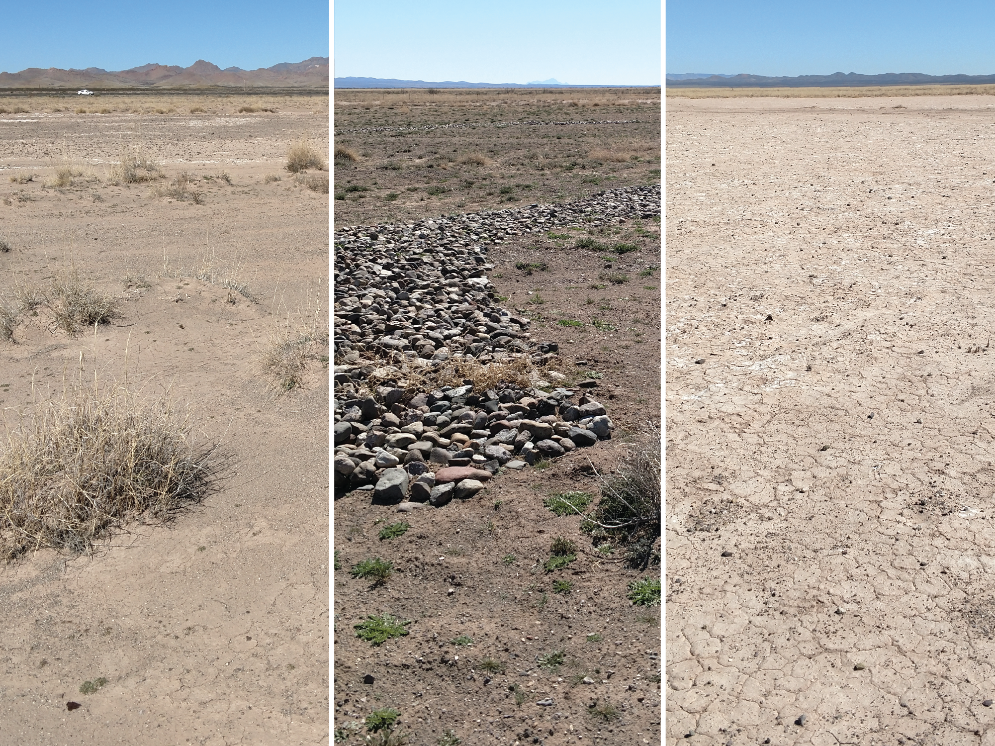
NMDOT is working with the USDA Jornada Experimental Research Station on two research contracts to support our mitigation work. One project is studying the effectiveness of the work we are doing are several locations in the Lordsburg Playa area and the other is monitoring air quality adjacent to several sites to determine dust emissions. Additionally, NMDOT is also monitoring plant density and species diversity on several locations on which we have worked.
Lordsburg Playa Dust Mitigation
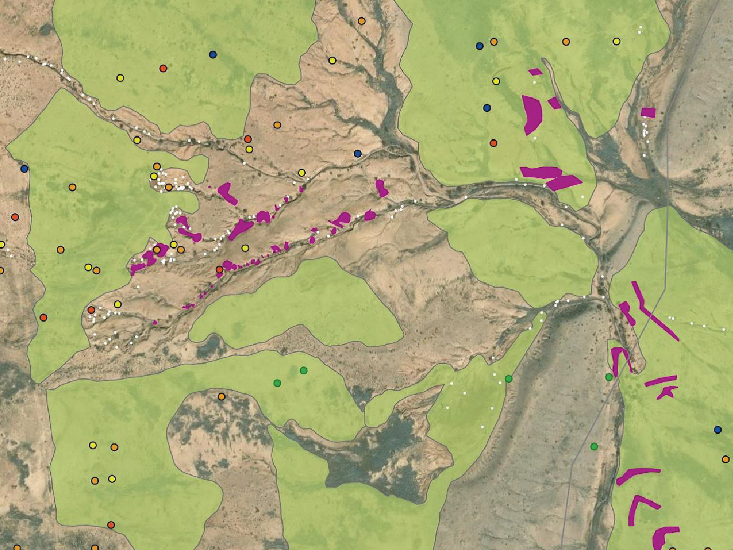
Monitoring Transects: Detail 2020 – 2024
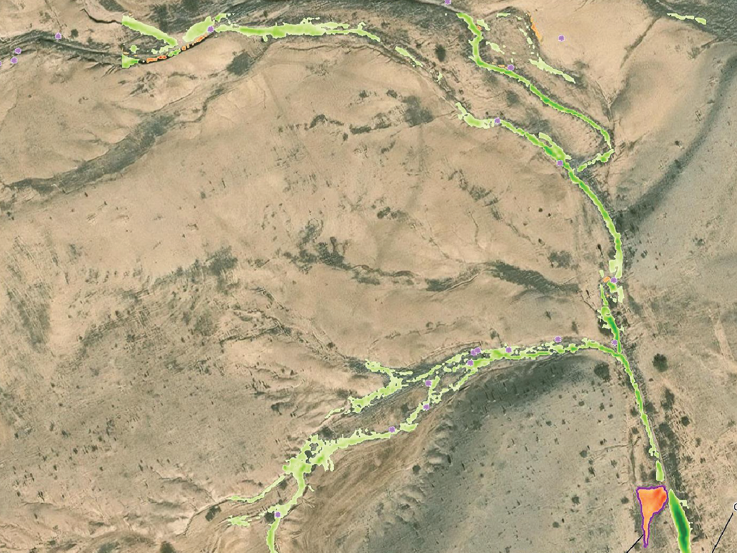
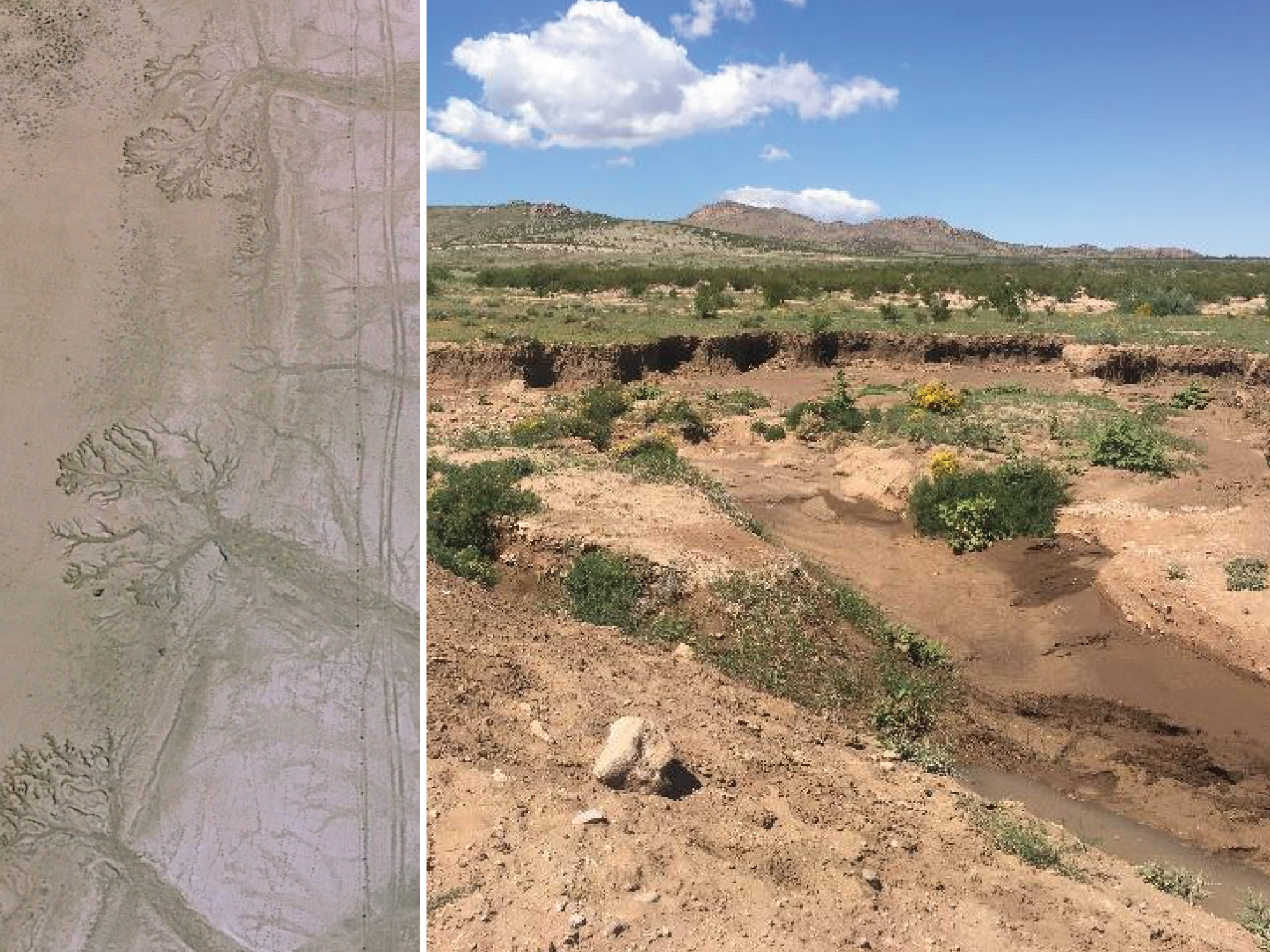
Sediment Deposition: 2018 and 2023
Continued Interagency Cooperation
Cooperative Agreements
NMDOT is working on a cooperative agreement with the BLM and State Trust Lands for the entire I-10 corridor from the Arizona State line to Las Cruces. Other involved governments and agencies would also participate in this agreement.
Through this agreement, a multi-year drainage study will be performed by NMDOT. With this information, and the identification of dust hot spots on the entire I-10 corridor, we can prioritize work actions. Additionally, land management grazing strategies may be informed by ongoing research as to the carrying capacity of lands adjacent to NMDOT routes.
Program Partners & Collaboration
Resources
Learn More and Access Program Tools
This webpage is your central location for program materials, additional resources:
Controlling Dust on Your Property
Brochure | March 2023
Lordsburg Playa Watershed Restoration
Presentation | August 2026
Lordsburg Playa Watershed Collaborative Efforts
Presentation
Fugitive Dust Program
Website | City of Albuquerque
Windblown Dust
Website | New Mexico Environment Department
Establishing quantitative benchmarks
Article | Elsevier / Ecological Indicators
Mitigating severe dust storms using the K.I.S.
Poster | UTEP / El Paso Community College
Contact Us
Questions or More Information
For questions about the NMDOT Sustainability Program, Envision, or available resources:
William Hutchinson,
Roadside and Community Design Section Manager
Phone: 505-795-1275
Email: Williams.hutchinson@dot.nm.gov
John Busemeyer,
Landscape and Revegetation Specialist/Environmental Scientist
Phone: 505-490-3985
Email: john.busemeyer@dot.nm.gov