
Truth or Consequences Road Diet Project
I-25 Business Loop 11 Road Diet Enhancements in Sierra CountyNMDOT Control No. 1102340
Project Update
Roadsafe Traffic Systems (Contractor) will begin making pavement marking adjustments to the downtown T or C area starting on March 23rd. Lane closures will be in place for the contractor to eradicate existing striping and will then fog seal the area. This project is expected to take no more than 60 working days. Contractors’ working hours are Monday through Friday from 7 a.m. to 7 p.m.
Project Overview
In Spring 2025, the NMDOT completed a $5.6 million paving and road diet project along the I-25 Business Loop in Truth or Consequences (T or C), Sierra County, New Mexico. The project limits covered Date Street, Broadway, and Main Street (5.5 miles total).
This project aimed to improve public safety in downtown T or C by implementing a road diet to increase visual friction and reduce vehicle speeds (see Photos 1 through 6). Recommended in the 2021 Multimodal Transportation Safety Plan, the road diet addressed key concerns including speeding and wrong-way driving in the downtown corridor.
This safety initiative complements a recently completed mill and inlay project along Business Loop 11, which addressed pavement conditions and upgraded ADA ramps. While that effort focused on infrastructure improvements, the road diet project specifically targets traffic calming and enhances safety for all roadway users.
Exciting Safety Upgrades Coming This Fall!
As part of the T or C Road Diet Project, we’re making some important improvements to enhance safety and traffic flow! Here’s what you can expect:
What’s Changing?
Originally, the road featured a two-lane, one-way design with parallel parking on both sides (see Photo 1). Using the recent traffic safety recommendations, a road diet concept was implemented that separated cars – in operation as well as parked – from bicycles (see Photos 2-6 and Figure 1). In the revised road diet layout, the road will remain a single-lane, one-way street with parallel parking, but the existing multi-use path will be transformed into a one-way bike lane alongside the travel lanes. The revised layout is a more traditional concept of a road diet (see Figure 2), while it introduces an additional conflict point between bicyclists and vehicular drivers when entering and exiting the outside parking areas, it still improves the overall safety for both cyclists and drivers, compared to the original condition.
Key Enhancements
- New Pavement Markings: We’re reconfiguring the road markings to mitigate municipal safety concerns while maintaining the road diet concept to improve road user safety (see Figure 3).
- Upgraded Signs & New Installations: Keep an eye out for new and clearer signs to guide you along the road with ease.
- Delineator Systems: These new markers will improve visibility, especially during low-light conditions (see Figure 4).
- Other Construction Enhancements: Various updates will support the new road layout, ensuring smoother and safer traffic flow for everyone.
What's Next?
These upgrades will be observed and evaluated to determine if future improvements such as speed radar feedback beacons would further enhance safety on the road.
Timeline:
This project is funded by the NMDOT Highway Safety Improvement Program (HSIP) and will begin construction in late Fall 2025.
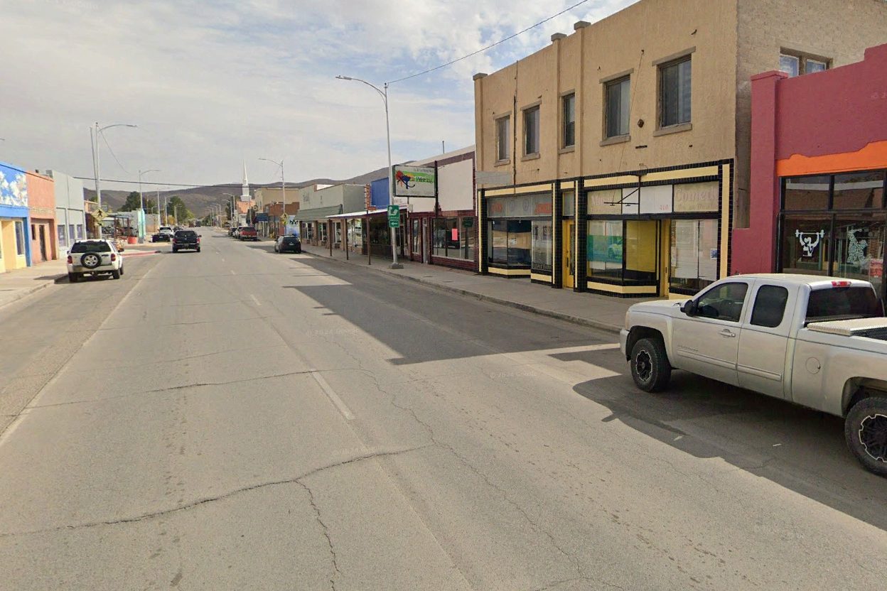
Photo 1. View of original design on the I-25 Business Loop featuring a two-lane, one-way road with parallel parking on both sides.
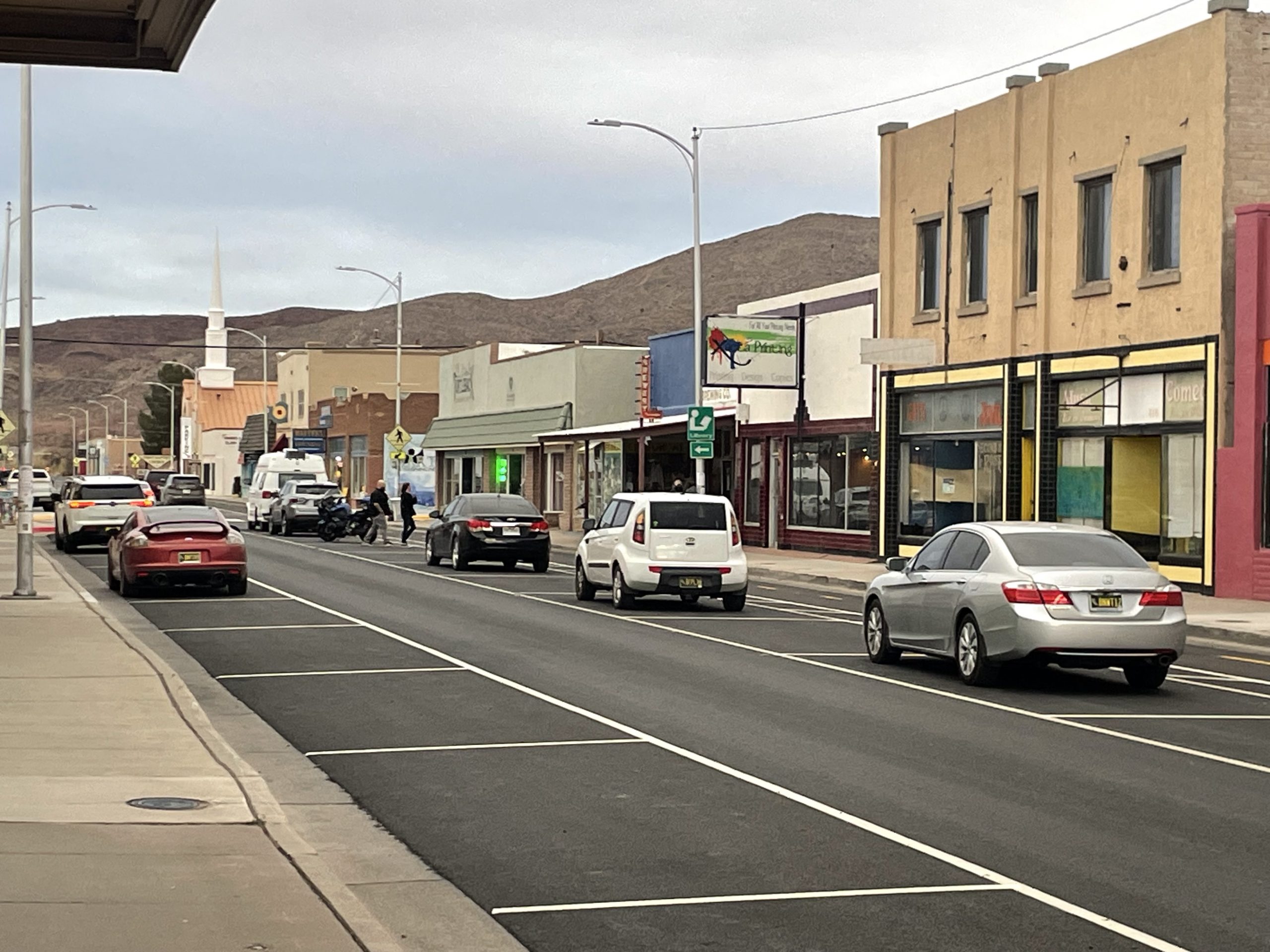
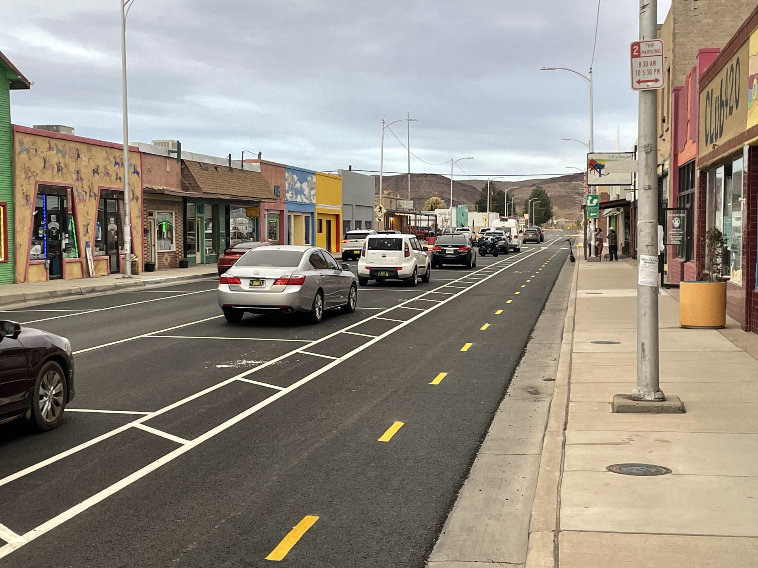
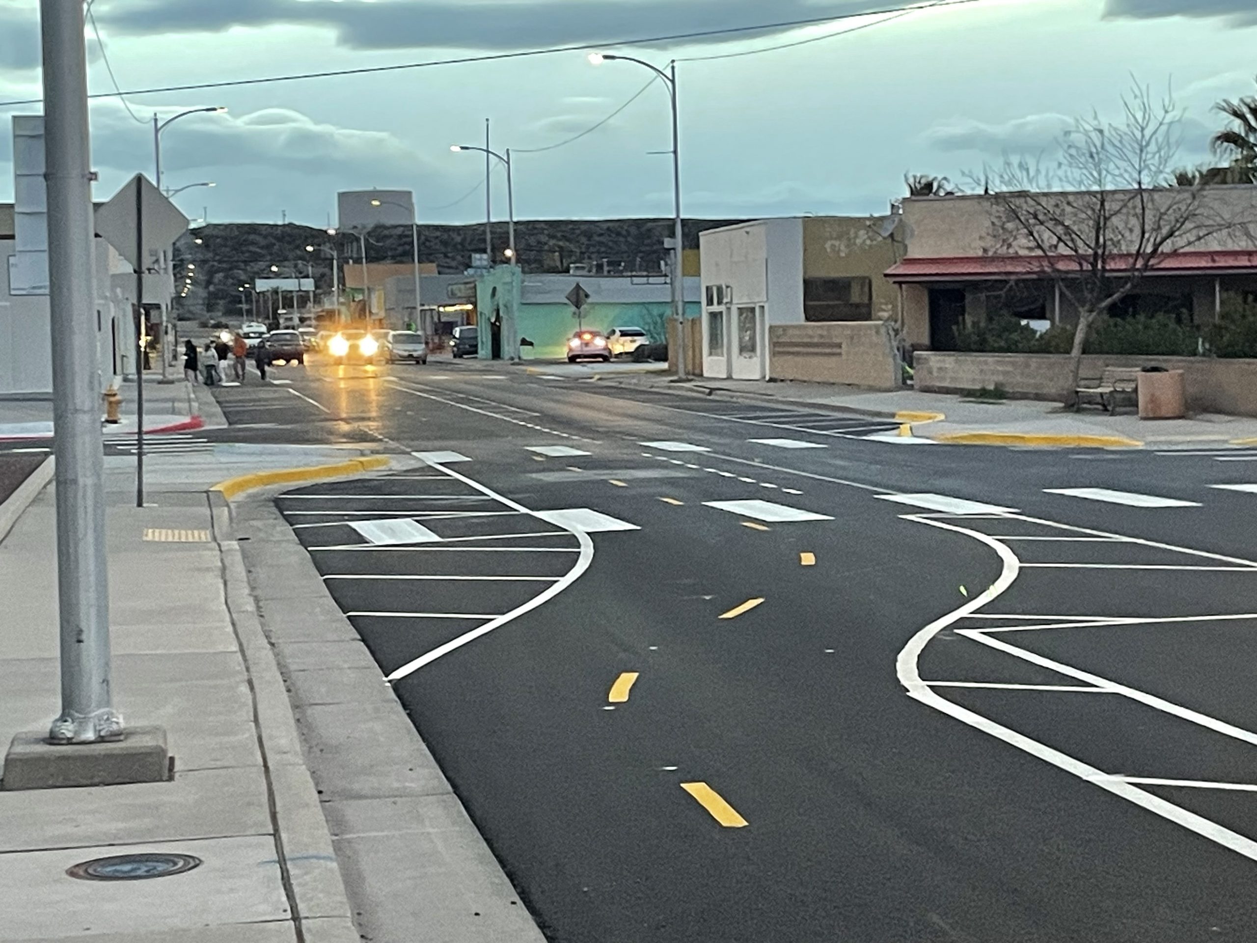
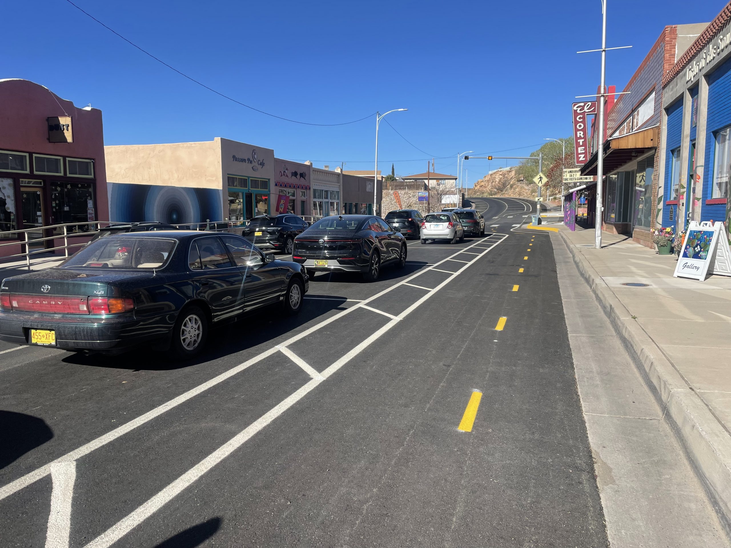
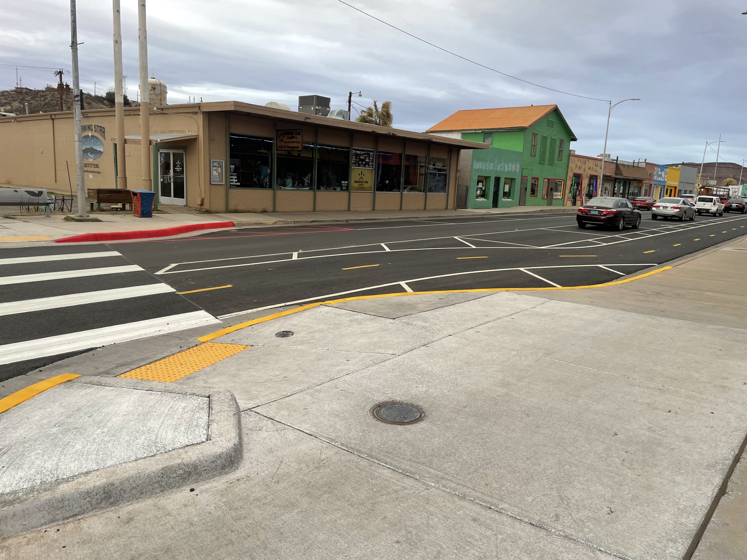
Photos 2-6. View of initial repaved and restriped roadway on the I-25 Business Loop between Austin Ave. and First Ave that occurred in Spring 2025.
(Click to see multiple images from within the corridor)
What is a Road Diet?
A Road Diet is a traffic calming strategy that reallocates roadway space to improve safety, enhance mobility, and support a better quality of life for all users. Typically implemented through low-cost measures like restriping, Road Diets reduce vehicle lanes to slow traffic, increase driver awareness, and create space for features such as bike lanes, pedestrian paths, or turn lanes.
FHWA Road Diet Video

Figure 1. Initial Road Diet Typical Section for the I-25 Business Loop between Austin Ave. and First Ave.

Figure 2. Revised Road Diet Typical Section for the I-25 Business Loop between Austin Ave. and First Ave.

Figure 3. Revised mid-block concept.

Figure 4. Revised intersection and driveway concept.
Thank you for your patience as we work on these upgrades. We’re committed to making your travel experience safer and more enjoyable—stay tuned for more updates!
BACKGROUND HISTORY
T or C, located in the Rio Grande Valley of southern New Mexico between Las Cruces and Albuquerque in Sierra County, was originally known as Hot Springs in the early 1900s, named for its renowned geothermal mineral waters (Figure 2). Today, the city’s historic Hot Springs Bathhouse and Commercial District continues to attract tourists, along with its unique shops, museums, art galleries, vibrant arts scene, and monthly Art Hop. These attractions contribute to high pedestrian, bicycle, and motor vehicle traffic volumes, particularly in the downtown corridor.
The City of T or C identified pedestrian safety as a major concern in the downtown district and two heavily traveled corridors in the northern part of the city. These corridors serve critical community functions, providing access to local schools (from elementary to high school) and the regional hospital. Given the high levels of multimodal use in these areas, enhancing the safety of vulnerable road users—especially pedestrians and bicyclists—was a priority.
In 2021, the New Mexico Department of Transportation (NMDOT) and the City of T or C partnered to create a Multimodal Transportation Safety Plan. Additional partners included the Sierra County Road Department, T or C Police Department, City of Williamsburg, and T or C Municipal Schools. This inclusive, multidisciplinary collaboration identified key safety concerns and recommended targeted countermeasures to improve conditions for all road users.
Through public engagement and community input, several goals emerged: improving roadway safety for residents and visitors through better compliance with speed limits, enhanced pedestrian infrastructure, improved accessibility, clearer striping and signage, and reduced intersection conflicts.
One major recommendation from the Safety Plan was a road diet for the downtown corridor along Main Avenue and North Broadway Street to address issues such as speeding and wrong-way driving (Figure 3).
Multimodal Transportation Safety Plan
.")
Figure 2. Location of T or C, New Mexico (Click on the image to enlarge).
.")
Figure 3. Location of downtown corridor along Main Ave. and N. Broadway Street in T or C, New Mexico (Click on the image to enlarge).
FREQUENTLY ASKED QUESTIONS (FAQs)
How should drivers respond to emergency vehicles with the Road Diet?
Stay Alert – Listen for sirens and check mirrors frequently.
Move Right When Safe – If possible, pull into a parking stall, designated shoulder, or as far to the right as possible.
Avoid Intersections – Do not stop in the middle of an intersection; instead, clear it and then move right.
Come to a Full Stop – Once safely positioned, remain stopped until the emergency vehicle passes.
Resume Travel Safely – Check surroundings before merging back into traffic.
Will delivery trucks be allowed to stop in the one lane blocking traffic?
Delivery trucks are generally not allowed to block a travel lane, regardless of the number of lanes. If a truck obstructs traffic unnecessarily, it may be considered a violation, subject to citation under local laws. The road diet concept provides designated parking areas parallel to the travel lane to support efficient loading and unloading. In addition, private parking facilities and side streets may offer suitable alternatives.
Since it starts and stops, interrupted by diagonal white stripping, the driver must anticipate many blocks ahead where they will turn. What if one is unfamiliar with downtown?
The diagonal white stripes you’re describing is the buffer area which is restricted to all vehicles (incl. cyclists). Roadway and multi-use path users need to use caution during travel, especially when approaching a transition area, driveway, or an intersection where the path ends or merges into a different lane. The stripes within the buffer zone help guide users to safely transition onto another path or lane, generate open space to improve sight distance, and they signify that the space should not be occupied (no parking and/or driving).
Drivers and cyclists will complete turns out of their designated lane. No turning lanes are provided in areas where the multi-use path begins or ends. Main St and Broadway within the downtown area are one directional, single lane, low speed urban roads. Drivers have to slow down for turning movements. The new layout does not require lane changes.
What other cities have this ‘multi-purpose” lane?
Many other cities have implemented multi-use paths similar to ours. In District One, we have multi-use paths in Las Cruces, Anthony, Deming, and Silver City. I believe Elephant Butte has one primarily for golf carts. Additionally, larger cities often install multi-use paths throughout various areas to support commuters and improve transportation options.
How many vehicle accidents have there been since the striping was completed, and when was the striping completed? Please include all fender benders, including cars bumping into vehicles parked in the middle parallel parking lane.
The DOT has not been made aware of any traffic incidents in the downtown area, please reach out to your local police department for additional information. As we move forward NMDOT will be relying on traffic safety data as part of the conversation for evaluating the success or failure of the road diet.
Who designed the striping?
The design was created by the NMDOT Engineering team. The city has for many years requested a single lane road to include bike lanes. The ask was to have 45 degree parking like you might see in a “typical” downtown. NMDOT regulations for this type of road prohibited traffic backing into oncoming traffic.
The unique traffic striping forces drivers to try to decode what the striping means while driving. Sure, locals will eventually adapt, but what about tourists? Do you think this striping is encouraging or discouraging tourism?
There is a second part to the design that is in process right now. Part 2 will provide
additional signage and striping. I have requested NMDOT to provide me with any
training video they would have to help answer questions. I have also requested a
training – public information meeting within the next 30 days to help.
The effects on tourism will need to be reviewed over a longer period. The six-month review will be able to answer this question.
What is the broken yellow stripe in the middle of a lane?
The yellow striped portion of the road is a multi-purpose path. The yellow striped indicates that bike traffic can move both ways on the path. The path is open to all forms of alternative transportation such as skateboarding, Bike, powered ADA carts, ect. The path is not intended for motor vehicles.
Why not angled parking?
According to Section 66-7-352 of the 2018 New Mexico Statutes (Chapter 66, Article 7 – Traffic Laws), local authorities may permit angle parking by ordinance, but such parking is prohibited on federal-aid or state highways unless the state highway commission has determined that the roadway is wide enough to accommodate angled parking without hindering the free flow of traffic.
With the new police station proposed at 210 Main Street, how are the police going to get onto Main Street with a blind corner and only one lane road, especially on a major weekend?
The concept of the road diet was presented and discussed with local police department. No concerns related to sight distance or the reduction to a one-lane concept were identified. For further information and/or comments please coordinate with your local emergency service providers.
What is the legal usage of the multi-use path? Is it only for turning? Is it for bike riders? Is it for golf cart type vehicles?
A multi-use path is a shared pedestrian and bike way that is physically separated from motor vehicle traffic by an open space or barrier, and within a highway or independent right of way. In addition to pedestrian and bicycle use, the shared use paths may also be used by, skaters, wheelchair users, joggers, and other users. Multi-use paths are very common across the US and most out of town visitors may already be accustomed to the uses and rules of a multi-use path. Its purpose is to provide a safe and separate space for these users, especially in areas where motor vehicle traffic can be heavy.
Motorized vehicles are generally not allowed on multi-use paths unless explicitly stated (such as for authorized vehicles, like maintenance vehicles or, in some cases, golf carts, but typically only in specific areas where permitted).
Turning: The multi-use path is not a designated turning lane. At intersections where the path crosses a side road approaching vehicles shall yield to pedestrians and cyclists. Intersections are marked by appropriate signage and pavement markings (Stop sign/Stop bar). The path itself is continuous and bi-directional throughout the downtown area.
Pedestrians and bike riders are commonly the primary users of multi-use paths. The paths were designed to allow cyclists to travel in both directions along Main St and Broadway. This will ensure they have a safe, dedicated area rather than traveling against (wrong way) vehicular traffic. All multi-use path users should always adhere to local ordinances and federal traffic rules and use the path as directed.
What is the rhyme or reason to the white diagonal striping that interrupts the buffer and multi-use path?
The white diagonal striping that interrupts identifies the buffer zone. The buffer zone separates either the parallel parking row or the travel lane from the multi-use path. The buffer zone is designed to improve safety and guide traffic flow. These markings identify areas where vehicles and bicycles should not park or drive. In curved areas, larger vehicles (Semi-trucks) are allowed to temporarily encroach into the buffer zone to safely operate within a road diet zone. While the striping may seem confusing at first, it does help drivers navigate the area more safely, especially near intersections since it ensures adequate sight distance. The buffer zone provides additional space (safe zone protected from approaching vehicles) for drivers who want to turn onto Main St. or Broadway. After coming to a full stop at the stop bar to yield to pedestrians and bicyclists, the driver is allowed to slowly move forward into the multi-use path and next to the buffer zone to visually confirm that it is safe to complete the turning movement.
Did this striping decrease or increase parking spots?
Parking spots have stayed relatively the same in the downtown area, additional dedicated parking was added.
The purpose of the proposed road diet and striping changes is to reduce speeding, eliminate blind corners, and improve access to local businesses for drivers, cyclists, and pedestrians. Although the speed limit is set at 25 MPH, recent studies show that many drivers are exceeding this limit, creating unsafe conditions for all roadway users. The new striping design introduces “visual friction,” which encourages drivers to slow down and pay closer attention to the corridor.
The new striping allows for 10-ft wide parallel parking rows adjacent to a single/one-directional 11-ft wide travel lane. On the opposing side a 10-ft wide multi-use path, separated by a yellow dashed stripe into two 5-ft lanes, was created to allow two directional use by pedestrians and bicyclists. Dedicated turning lanes do only exist in the proximity where the traffic pattern changes and vehicular traffic merges from two lanes into one lane. Within the downtown area vehicles will enter and exit (turn) directly from the 11-ft wide travel lane into the side streets. The buffer zone (striped diagonally) varies in width and is located either in between the parallel parking row and the multi-use path or in between the travel lane and the multi-use (normally near intersections and driveways) to ensure sight distances are adequate.
Benefits of Road Diets
Road diets offer advantages to all users of the roadway, including cyclists, pedestrians, and motorists. These benefits may include:
• A reduction in crashes by 19% to 47%.
• Fewer rear-end collisions.
• Fewer right-angle and sideswipe crashes.
• A decrease in speed differentials due to lane reductions and the addition of roadway markings that enhance “visual friction” and attract drivers’ attention.
• Promotion of a more community-oriented “Complete Streets” environment.
• Fewer lanes for pedestrians to cross, improving safety.
• The possibility of incorporating bike lanes within the existing road width.
• The opportunity to repurpose surplus roadway space for on-street parking, bike lanes, or multi-use paths.
• Simplified road scanning and gap selection for drivers turning from side streets.
• Compliance with ADA accessibility standards.
Let us know if you have more questions.
Email: Ami.Evans@dot.nm.gov
Contact: Ami Evans
NMDOT Public Involvement Officer
2912 E. Pine St.
Deming, NM 88030
Phone: 575-640-5981
Control Number: CN 1102340