
I-40 Manuelito Interchange
I-40 Milepost 7.9 to 8.9 near Manuelito in McKinley CountyNMDOT Control No. 6101600
STUDY OVERVIEW
WHERE IS THE STUDY AREA LOCATED?
The study area is in McKinley County, New Mexico, at the Interstate 40 (I-40) and New Mexico Highway 118 (NM 118) interchange (Exit 8), approximately 3.4 miles east of Manuelito. It includes a one-mile segment of I-40, from milepost 7.9 to 8.9.
The project area is near several communities and local facilities, including the Manuelito, Defiance, and Mentmore communities, as well as nearby schools and community centers such as Manuelito Chapter House, Tobe Turpen Elementary School, Gallup Christian School, the Manuelito Navajo Children’s Home, and Southwest Indian Ministries – Church of God. Land surrounding the project area includes a mix of private property, Navajo Nation land, and BNSF Railway property.

Figure 1. Project Area Map (click on the image to enlarge).
Note: Nearby bridges (Bridge Nos. 3488, 6281, and 6282) were not included as part of this study.
PROJECT HISTORY
The New Mexico Department of Transportation (NMDOT), in partnership with the Federal Highway Administration (FHWA), is completing a study of the Manuelito Interchange and recently identified a new improvement option that will advance into project development later this year.
The study began in 2023 and focused on understanding current conditions and needed improvements.
- In March 2024, NMDOT hosted a public meeting at the Manuelito Chapter House to share initial findings and gather community input.
- In August 2024, study results and a preferred alternative were shared through a pre‑recorded online presentation.
- The study phase concluded in September 2024 with the development of a preliminary design for Alternative 2B.
Because of the project’s cost and scope, a Value Engineering (VE) review was required to ensure the best balance of cost, performance, and quality. This VE process, completed in 2025, resulted in the creation of a NEW recommended alternative for the Manuelito Interchange.
FUNDING
Funding from the Federal Highway Administration (FHWA) and the State of New Mexico is supporting project design. While construction funding is not available yet, the District will continue working to secure funding so the improvements can move forward.
NEW INTERCHANGE ALTERNATIVE
The new interchange alternative developed during the 2025 Value Engineering session features a modern diamond‑style layout. In this concept, NM 118 would cross over I‑40 at a right angle instead of passing underneath at a skew. This design improves bridge performance, reduces overall costs, and creates safer, smoother ramps by removing sharp curves and the offset intersection.
Additional benefits include improved sight distance along NM 118, exit ramps with adequate stopping distance, and entrance ramps that better support acceleration and merging. The speed limit on NM 118 would remain unchanged. This alternative would require some additional private right‑of‑way, and construction would aim to minimize closures to NM 118 and the ramps as much as possible. The design also includes extending Lupton Road to meet the NM 118 intersection.
NEXT STEPS
The study team is wrapping up its work and expects to finish the study this summer. After a final review and approval by FHWA, the team will begin designing the new interchange. The goal is to complete the design by Fall 2027.
County
McKinley
District
District 6
STIP Number
6101600
Status
Study and Design
Contact
Central Region Design
Project Dev. Engineer
PROJECT RESOURCES
EXISTING CONDITIONS
I-40 is the primary west-to-east route to and through central New Mexico and is a primary freight route. In the study area, I-40 is a rural, divided four-lane interstate with a posted speed limit of 75 miles per hour. NM 118 is a rural two-lane highway with a 30-mph posted speed limit. NM 118 follows the route of the former historic Route 66 and parallels I-40 for most of its length. A major element of this study is the I-40 bridge (Bridge No. 6502) over NM 118 at Exit 8. As part of the information gathering stage, the team collected data on the existing conditions for the roadway, right-of-way, bridge, geotechnical, drainage, utilities, safety, traffic, land use, and environmental resources to inform the need for improvements and influence the development of the initial design alternatives.
SOME OF THE EXISTING ENGINEERING FEATURES AND PHYSICAL CONDITIONS
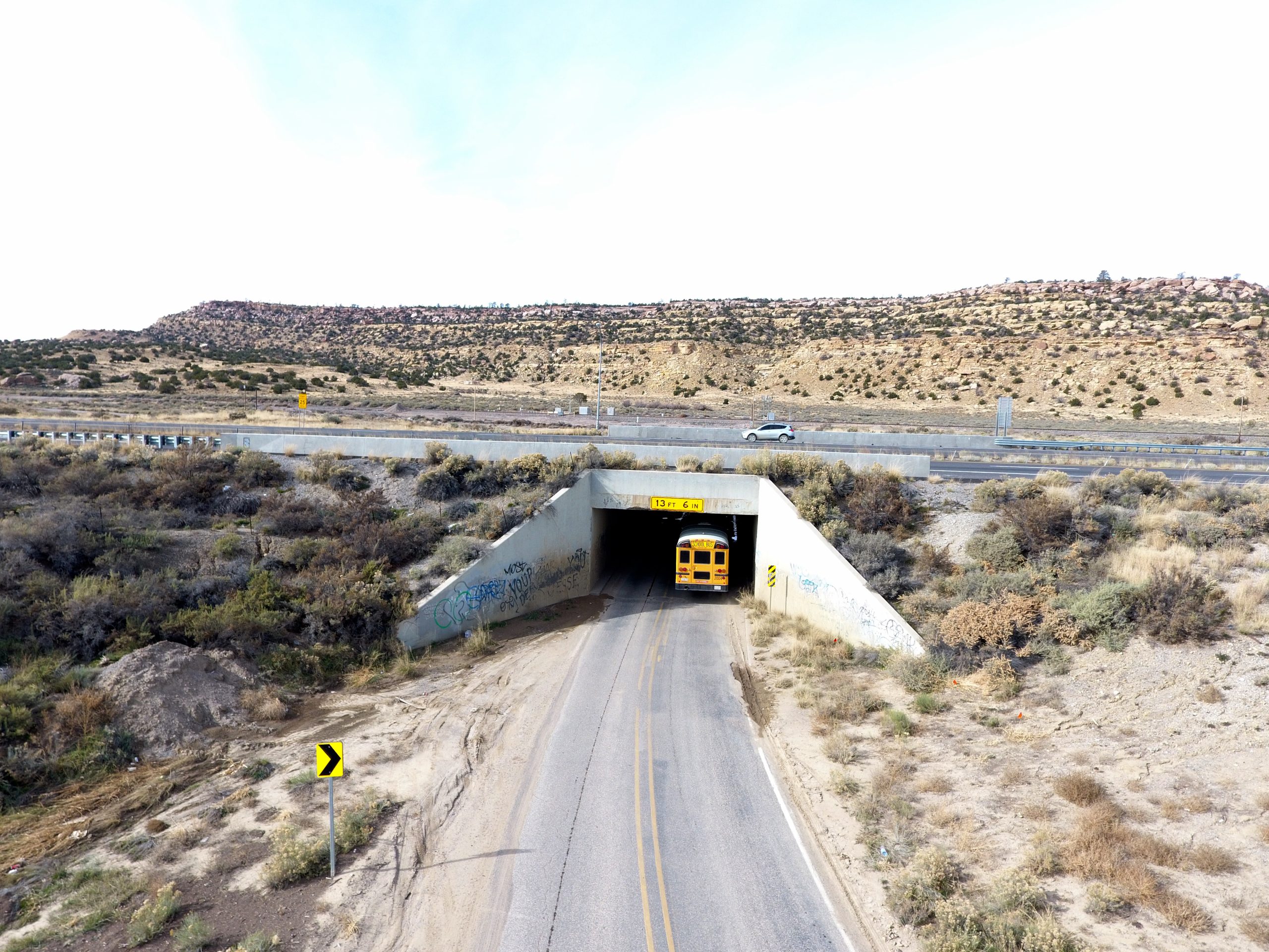
BRIDGE HEIGHT AND WIDTH CLEARANCE:
The I-40 bridge (Bridge No. 6502) over NM 118 has a height of 13.5 feet and width restrictions. Semi-trucks traveling or diverted to this route do not have enough space to safely travel under the I-40 bridge.
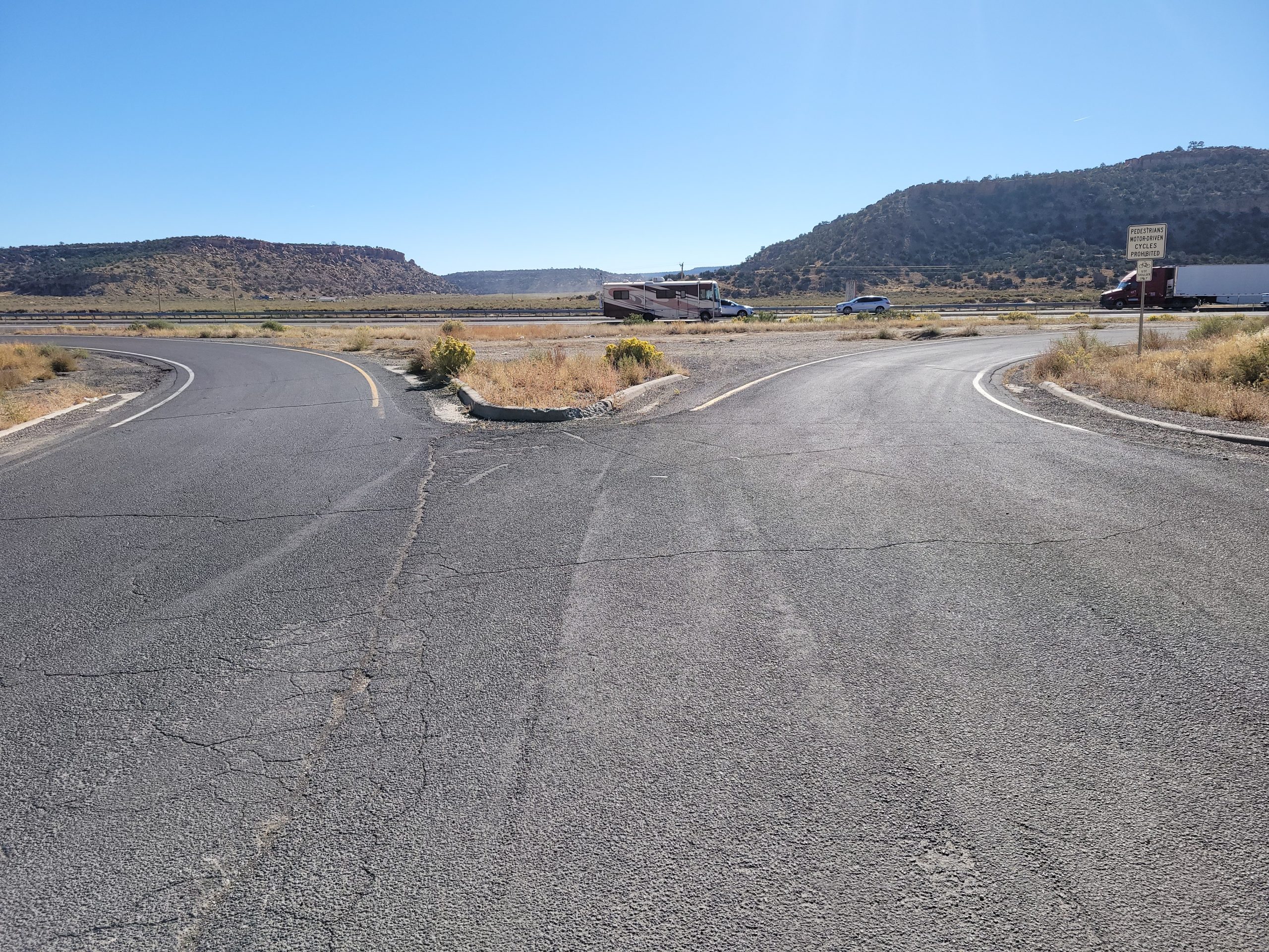
SIGHT DISTANCE approaching I-40 from NM 118:
View of intersection with the I-40 westbound off-ramp approaching NM 118 and the I-40 westbound on-ramp from NM 118. There is a limited view of oncoming I-40 traffic for those entering the on-ramp.
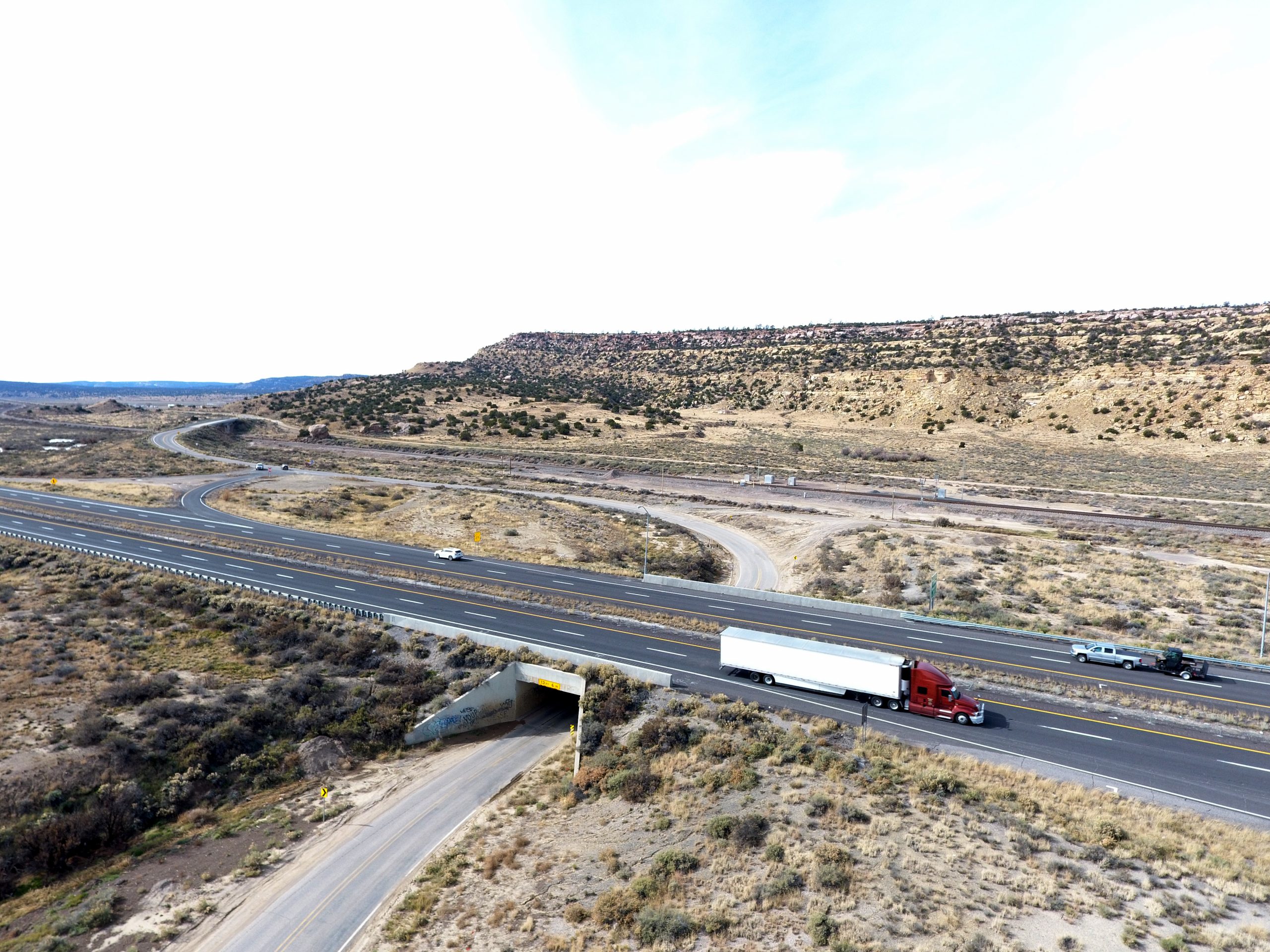
INTERCHANGE TYPE:
The existing I-40 and NM 118 interchange does not meet current design standards and is complex and unclear for drivers to navigate.
PUBLIC INVOLVEMENT
PLEASE PARTICIPATE IN THIS VIRTUAL PUBLIC EVENT
WHEN: June 17 to July 16, 2026
WHERE: Online Pre-Recorded Presentation Available
A recorded presentation outlining the study process, the new recommended alternative, and the project timeline is provided below. We invite you to review these materials and share your questions and feedback as we update the study and move into design.
VISIT THE VIRTUAL EVENT PAGE
to view additional event resources and provide feedback to the project team.
PREVIOUS MEETING RESOURCES
EVENT #1 – Public Meeting Summary and Comments (PDF)
June 2024
EVENT #1 – Public Meeting Factsheet (PDF)
June 2024
EVENT #2 – Presentation (PDF)
July 2024
EVENT #2 – Factsheet (PDF)
July 2024
I-40 Manuelito Interchange
PROJECT TIMELINE
2023
- Gather Existing Conditions Data
- Identify the Needs within the Study Area
2024
- Develop Alternatives and Conduct Detailed Analysis
- Host Public Event #1 (Spring 2024)
- Identify Preferred Alternative
- Host Public Event #2 (Summer 2024)
- Complete Phase A/B Study (Fall 2024)
2025
- Develop Preliminary Design (30%)
- Conduct Value Engineering (VE) Analysis
- Identify NEW Interchange Layout
2026
- Host Public Event #3 (Summer 2026)
- Prepare a Phase A/B Study Addendum
- Finalize Phase A/B Study
- Develop New Interchange Design
2027
- Complete New Interchange Design (Fall 2027)