
U.S. Highway 60 Socorro Alignment Study
Milepost 136.2 to 139 in SocorroNMDOT Control No. 1102050
PROJECT OVERVIEW
BACKGROUND INFORMATION
The New Mexico Department of Transportation (NMDOT) is conducting the U.S. Highway 60 (U.S. 60) Socorro Alignment Study. The study area is located about 75 miles south of Albuquerque in the Town of Socorro, New Mexico. U.S. 60 is an east-west United States highway spanning 2,655 miles across nine states. This study will focus on a section of this highway between mileposts 136.2 and 139.0.
This portion of U.S. 60 transitions from a rural highway into a population center, which contributes to the complexity of analysis and design required for this study. Community centers, residences, schools, and local businesses all occupy the same short stretch of highway used by both local traffic and road trippers. Changes in speed, lanes, and driveway density prevent a uniform design and as such require a context-sensitive design to convey both local and through traffic safely.
The purpose of the study is to evaluate the condition of roadway, traffic, and drainage and assess the features against current standards to determine whether improvements are needed to enhance safety, operations, and multimodal accessibility in the study area.
FUNDING
Funding for the study phase currently includes state funds through House Bill 2-2021 Legislative Session (HB2-21) under Control Number 1102050.
TO STAY CONNECTED
IF YOU WANT TO JOIN THE MAILING LIST, please email Devin Kennemore at devin@pathfinderenvironmental.com

Study Area Map (click on image to enlarge).
County
Socorro
District
District 1
STIP Number
Status
Study and Design
Contact
Sherri Holliefield
South Region Design Manager
(575) 202-6594
PROJECT RESOURCES
EXISTING CONDITIONS
As part of the Phase A study process, the study team collected data on the existing conditions for the roadway, right-of-way, existing bridge, geotechnical, drainage, utilities, safety, traffic, land use, environmental, cultural and biological resources, and socioeconomic conditions that helped to identify the needs for improvement and guided the development of alternatives evaluated during the Phase B process.
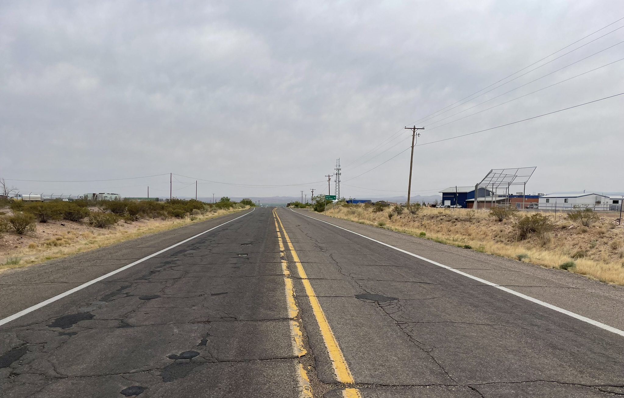
WEST - RURAL SEGMENT (Milepost 135.5 to 138.1)
Within the RURAL SEGMENT of U.S. 60 on the west side of town from the Mantanza Arroyo to the BNSF Railroad crossing, U.S. 60 is a rural two-lane undivided roadway with varying shoulder widths. There is no lighting and more than 19 driveways within a 1.4-mile section. The posted speed limit ranges from 35 to 55 miles per hour. The pavement is this segment is in fair to poor condition.
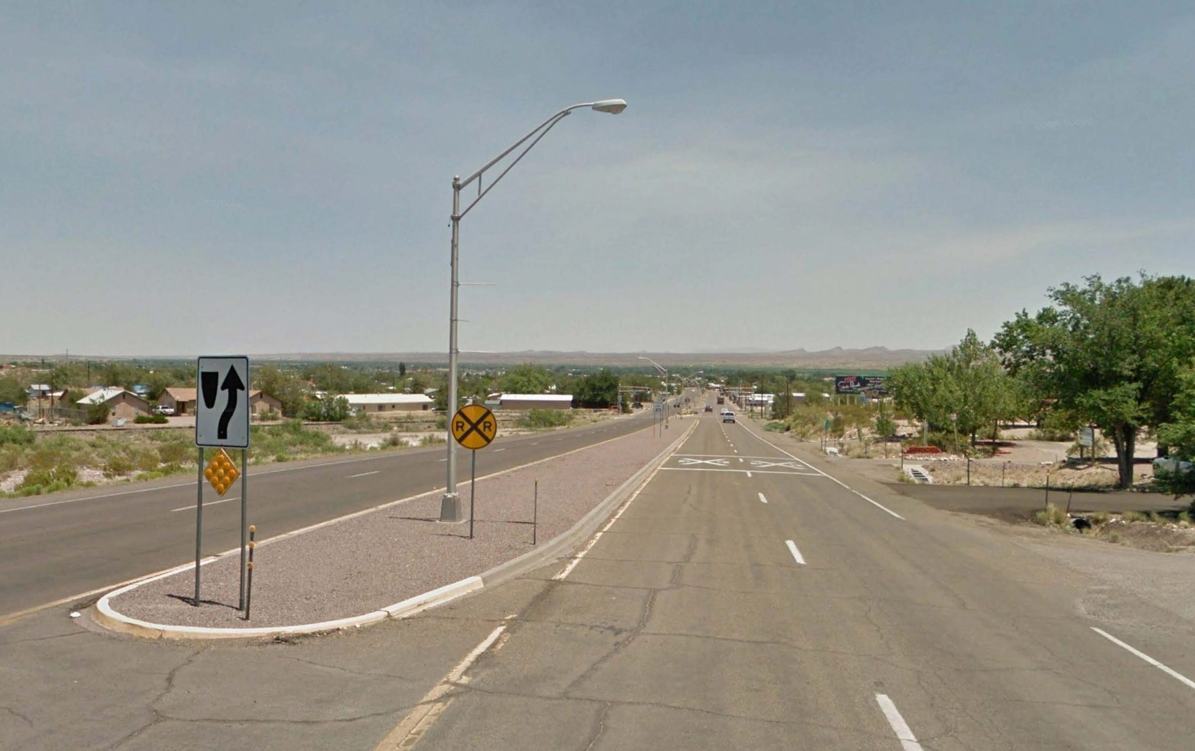
SOUTH - URBAN SEGMENT (Milepost 138.1 to 138.4)
The SOUTH URBAN SEGMENT between the BNSF railroad crossing and the “Y” intersection at 6th and Grants Street U.S. 60 is an urban 4-lane roadway with 12-ft travel lanes, 6-ft shoulders, a raised median, and limited lighting within a 0.65-mile section. The posted speed limit is 35 miles per hour. There is some on-street parking. Sidewalks are intermittent and not ADA-compliant. There are no bike lanes and no bus stops. Pavement conditions are fair.
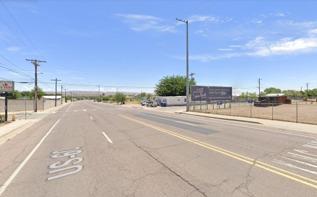
EAST - URBAN SEGMENT (Milepost 138.4 to 139.0)
The EAST URBAN SEGMENT between the “Y” intersection and California Street consists of a 4-lane undivided roadway with 12-ft travel lanes, 6-ft shoulders, and limited lighting within a 0.5-mile section. The posted speed limit is 35 miles per hour. There is some on-street parking. Sidewalks are intermittent and are not ADA-compliant. There are no bike lanes and no bus stops. Pavement conditions are fair.
PUBLIC INVOLVEMENT
THANKS FOR ATTENDING THE PUBLIC MEETING!
WHEN: October 9th, 2024
WHERE: Socorro Convention Center
Since the last public meeting in 2023, the team considered all the input received, refined the alternatives, and conducted a detailed evaluation to identify the recommended improvements for US 60. The purpose of the meeting held this month was to share the analysis results and receive your feedback before finalizing the study document this winter.
Click on the button to learn how to share comments with the team.
PUBLIC EVENT RESOURCES:
Resources from the meeting will be shared here.
Public Event #2 – Presentation
October 2024 (PDF)
IF YOU NEED ASSISTANCE, LET US KNOW!
If you need ADA accommodations, language translation, or would like paper copies of materials, please call Kayla Smith at 575-522-0049.
PREVIOUS PUBLIC ENGAGEMENT
If you were unable to attend the meeting last fall in October 2023, please feel free to review the materials below.
U.S. 60 Socorro Alignment Study
Study Timeline
SPRING / SUMMER 2022
Fall 2022
• Stakeholder Meeting – September 1, 2022
Spring / Summer / Fall 2023
• Evaluate improvement alternatives
• Prepare draft Alignment Study document
Summer 2023
• Stakeholder Meeting – July 19, 2023
Fall 2023
• Public Meeting – October 11, 2023
• Review alternative under consideration
WINTER 2023 / SPRING 2024
• Public input gathered
• Alternatives refined and evaluated in detail
SUMMER / FALL 2024
WINTER 2024 / 2025
• Completion of U.S. 60 Socorro Alignment Study