I-25 San Antonio Interchange Improvements
0.5 miles west of San Antonio between Milepost 139 to 140NMDOT Control No. 1102060
THANK YOU
for your participation in the public meeting hosted on Dec. 14th!
PROJECT OVERVIEW
BACKGROUND INFORMATION
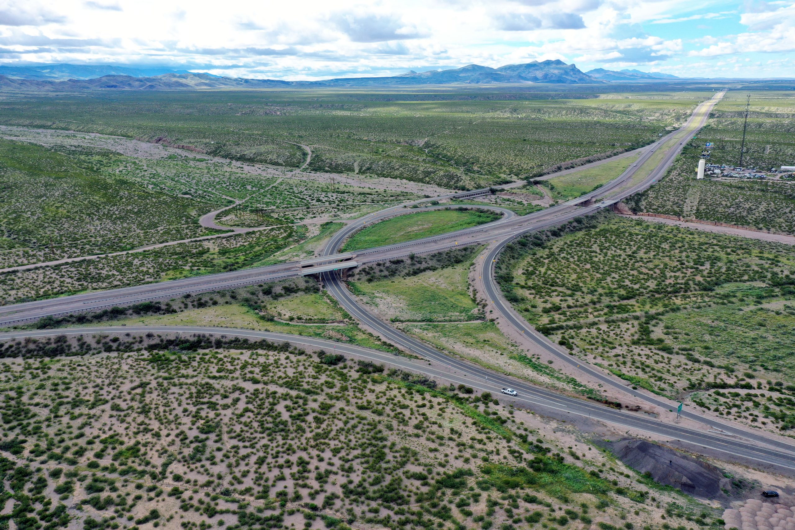
The NMDOT completed a study in July 2023 for Interstate 25 (I-25) between milepost 139 and milepost 140 at the U.S. Highway (US 380) Interchange, which is approximately ten miles south of Socorro and 0.5 miles west of San Antonio, New Mexico. The purpose of the study was to document existing conditions, develop several improvement alternatives, and identify a recommended alternative to carry into design.
ALTERNATIVES EVALUATED IN DETAIL
During the study process, the team developed and evaluated a No Build Alternative and three different Build Alternatives that could potentially address and mitigate issues identified with roadway, drainage, and bridge structures. Based on the feedback NMDOT received from the public during the study phase, improving safety along this stretch of highway is the main priority. The speed limit on I-25 has increased since the interchange was constructed and now the existing travel lanes along the curve between US 380 and Walnut Creek do not meet current NMDOT design standards.
- No Build Alternative
- Build Alternative 1: Enhancement to Existing Geometry
- Build Alternative 2: Diamond Interchange (match existing US 380 alignment)
- Build Alternative 3: Diamond Interchange (adjust US 380 alignment)

Project Area Map (click on image to enlarge).
WHERE ARE WE NOW?
Ultimately, Build Alternative 3: Diamond Interchange was recommended. Starting in the of middle 2023, the team moved from the study phase to the preliminary design phase.
ALTERNATIVE SELETED FOR DESIGN
Build Alternative 3: Diamond Interchange would entail:
- Adding acceleration and merge lanes for the Northbound and Southbound on ramps.
- Reconstructing I-25 through the horizontal curve to improve the superelevation to current standards.
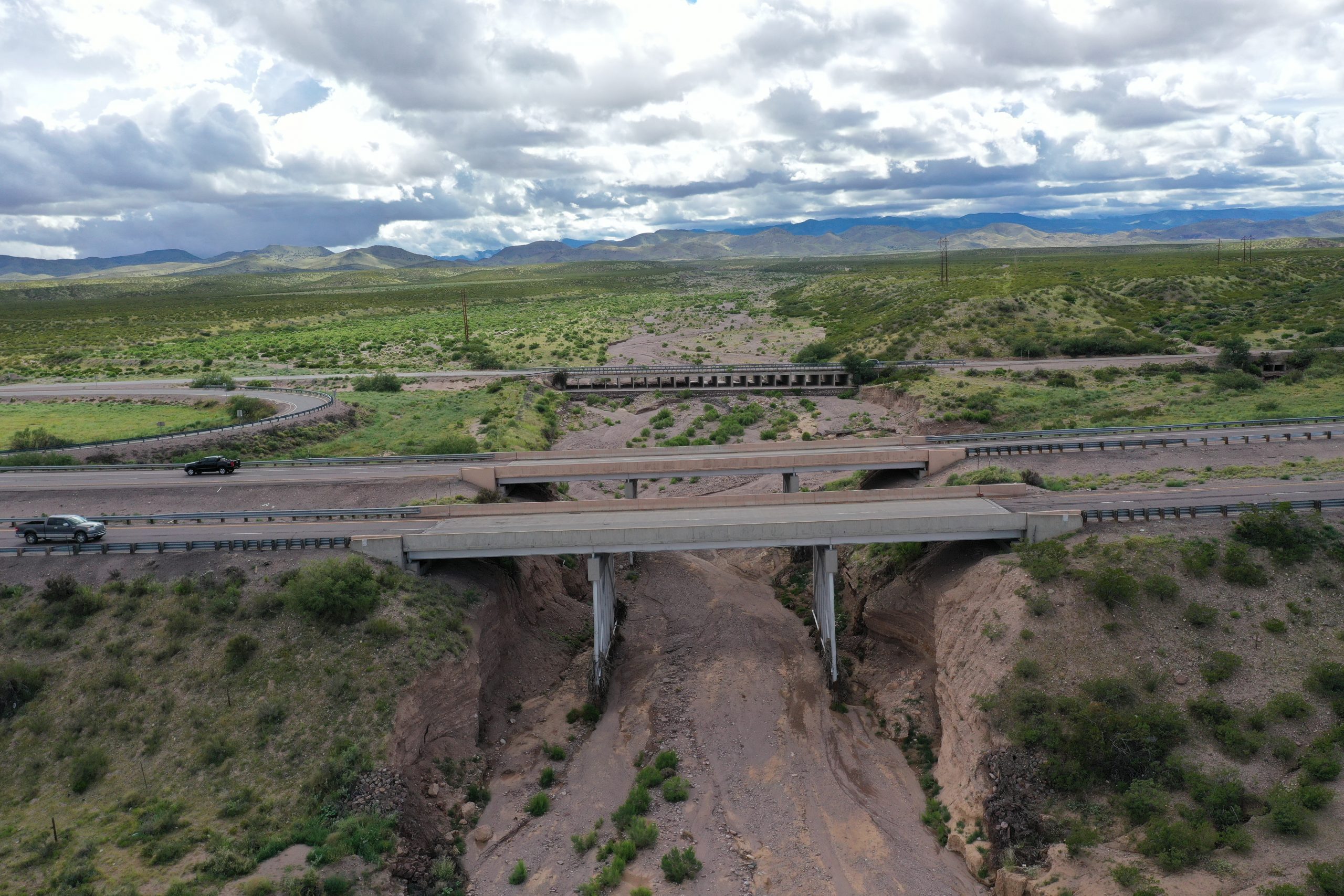
- Replacing the I-25/US 380 and I-25/Walnut Creek Bridges.
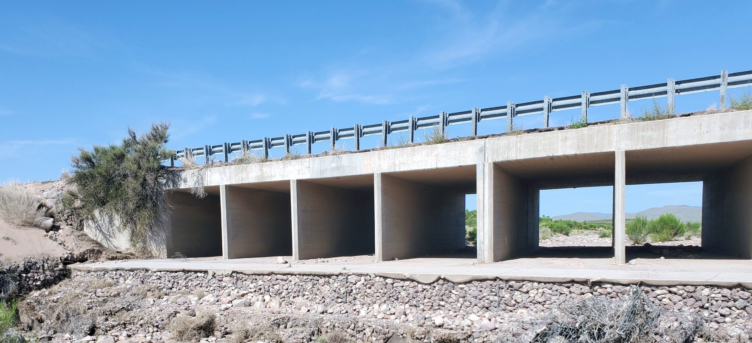
- Removing the Concrete Box Culvert crossing at Walnut Creek and all unnecessary segments of road within the interchange.
Build Alternative 3: Diamond Interchange
WHAT IS THE PURPOSE OF THE PROJECT?
The purpose of the project is to correct geometric roadway deficiencies, enhance drainage structures and protections to diminish scour and erosion, and provide a safe and efficient interchange that meets user expectations.
FUNDING
Funding for the study and design phases currently includes state funds through House Bill 2-2021 Legislative Session (HB2-21) under Control Number 1102060.
County
Socorro
District
District 1
STIP Number
Status
Design
Contact
Mark Salazar, PE
Project Development Engineer
(575) 888-7146
PUBLIC INVOLVEMENT
THANK YOU FOR YOUR PARTICIPATION
in the 3rd public meeting hosted on DEC 14, 2023
During the public meeting, the design team presented the proposed improvements for the I-25 San Antonio Interchange currently underway and went over comments and concerns received from the community in our previous public events. If you were unable to attend the virtual meeting, please watch the event recording below. A PDF of the presentation is also available.
PUBLIC ENGAGEMENT RESOURCES
Public Meeting #3 - Presentation (PDF)
December 2023
Public Involvement Plan (PDF)
August 2022
HOW TO SHARE COMMENTS?
Comments are being accepted from December 14, 2023, through January 13, 2024. Submit your comments by using any of the following methods:
Email: I25SanAntonio@hdrinc.com
Call: 505-357-7327
If no answer, please leave your name & best phone number and we will call you right back!
Mail: I-25 San Antonio Design Project
C/O Victoria Romejko, HDR Engineering
2155 Louisiana Blvd NE # 3000
Albuquerque, NM 87110
Online Comment Form: Visit the event page.
PREVIOUS ENGAGEMENT
First Public Meeting
The first virtual public meeting for the I-25 San Antonio Interchange Study was held on November 16, 2022. The meeting focused on the purpose of the study, existing conditions, issues in the area, proposed alternatives, and the next steps. Public comments were accepted between November 3 and December 15, 2022. The meeting summary, which includes a copy of the presentation as well as all comments and questions received, and responses is provided below.
Public Meeting #1 - Meeting Summary (PDF)
November 2022
Second Public Meeting - May 2023
The second virtual public meeting for the I-25 San Antonio Interchange Study was held on May 18, 2023. The meeting focused on issues in the area, the alternatives evaluated in more detail, and the next steps. Public comments were accepted between May 18 and June 17, 2023. The meeting summary, which includes a copy of the presentation as well as all comments and questions received, and responses is provided below.
PROJECT RESOURCES
PROJECT AREA SETTING
I-25 is the major north/south interstate system. Within the project area, I-25 is a rural, divided interstate with two 12-ft lanes in the northbound and southbound directions with 10-ft outside shoulders and 4-ft inside shoulders. US 380 consists of two 12-ft travel lanes with 8-ft wide shoulders as it approaches the nearby community of San Antonio to the east.
The land surrounding the San Antonio interchange is primarily undeveloped and rural with little to no development directly adjacent to the interstate. Businesses and homes can be found half a mile to the east in the community of San Antonio. The San Antonio Fire District is located directly east of the interchange on the south side of US 380. Cattle grazing and agriculture are the primary land uses in the vicinity of the study area.
PREFERRED ALTERNATIVE
Based on the study findings (see the Phase 1-A/B Report below), Alternative No. 3 was recommended to be advanced for further development. The interchange layout is modified to a tight diamond configuration with an adjustment of the US 380 alignment to the south to provide additional distance between the US 380 and Walnut Creek crossings. The improvements would correct the I-25 horizontal geometry, incorporate exit and entrance ramps that meet current design standards, replace the bridges at I-25/US 380 and I-25/Walnut Creek, and add drainage features to decrease erosion and scour.
This alternative would upgrade the interchange configuration to a more modern layout (diamond interchange) that meets user expectations, reduces temporary closures of US 380 during construction, and fulfills the purpose and need of the study by improving safety. A minimal amount of new right-of-way will be needed to accommodate the proposed improvements.
Build Alternative 3: Diamond Interchange Figure (JPG)